
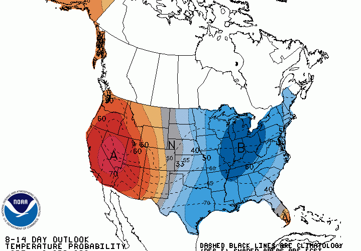
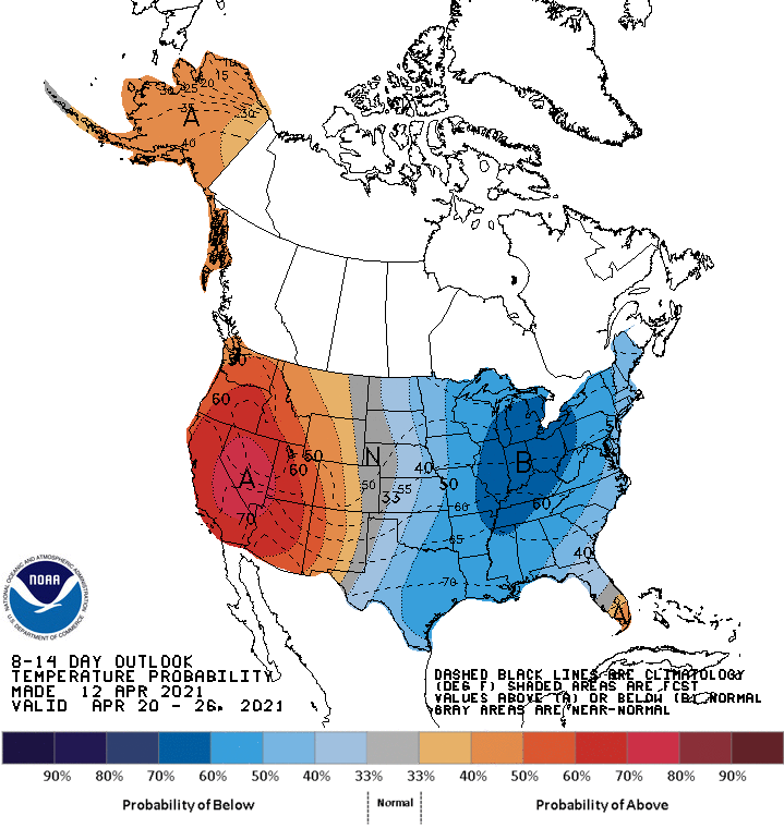
In both the 6-10 day outlook and 8-14 day outlook from NOAA CPC, both are highlighting a large area to our west to have the highest chances to see below normal temperatures. This is likely due to the GEFS showing persistent below-normal temperatures at least into the 21st. The outlook below covers from the 20th-26th.
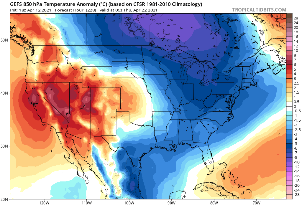
The below map of the GEFS showing temperature anomalies has a chilly look to it around the 21st. While our region likely won’t see the coldest temperatures out of this cold snap, there will still be a chill in the air.
What does this mean? It means that there won’t be any blowtorch conditions where it’s hotter than normal. This look also means a freeze in the mountains and a frost is still possible until later this month. Planting is still not advised.
CWA
You must be logged in to post a comment.