
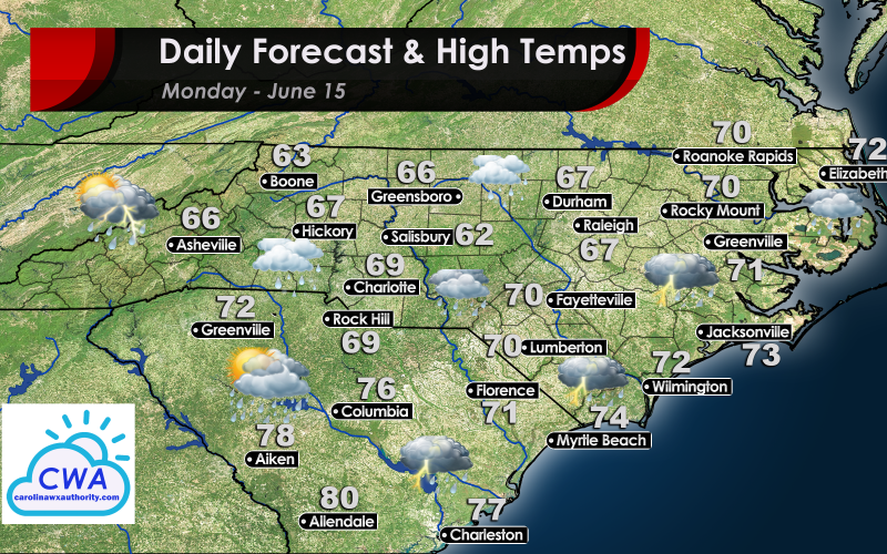
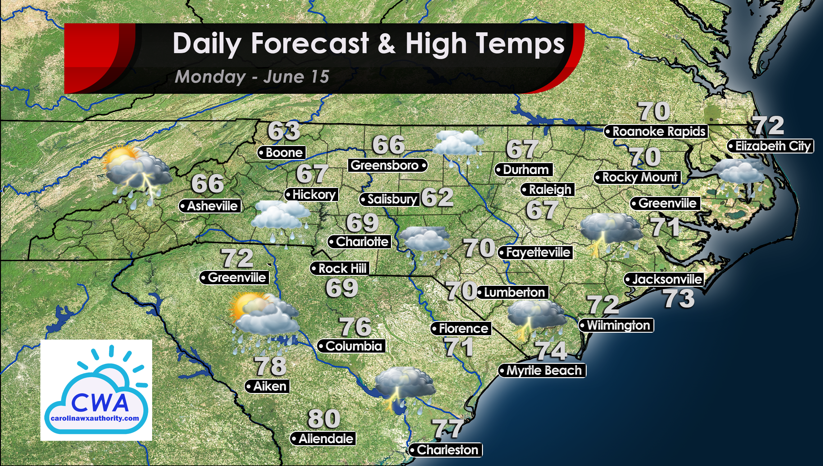
Clouds and Rain Dominate Monday
I hope you enjoy the rain. South and North Carolina are in for a wet week as clouds and rain dominate the region. An upper level low (like the one that brought us a week of rain at the end of May) is entering our region this week. The low will meander around the Southeast for the majority of the week, bringing daily rain and potentially a risk of flooding.
Monday Details: Cool, Cloudy, Wet
You can expect rain to overtake the region during the day on Monday. Rain showers will build from the southeast to the northwest. Central North Carolina should mostly avoid any thunderstorms, but the sun will be largely absent. Expect the occasional clap of thunder along the coast as well as in the mountains, especially in Boone, Asheville, and points west. Regardless, clouds and rain will dominate the region Monday.
On the plus side, the temperatures are going to be absolutely fabulous! High temperatures will struggle to break the 70° mark for all non-coastal locations, being kept in check by widespread persistent cloud cover.
Severe storms are not expected for the region, and any thunderstorms that do develop should be relatively minor.
You must be logged in to post a comment.