
We’ve seen some incredibly wet weather over the past 30 days, so when it’s time to say goodbye to spring and welcome in the longest day of the year this Saturday, you’d think we have said goodbye to April/May showers and cool temperatures a long time ago. Well apparently the year 2020 continues to surprise.
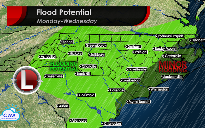
Another spell of clouds, rain, and cool weather is taking residence in the Carolinas and Virginia for at least the first half of the week as a strong upper level trough drops southeast and cuts off and slows to a crawl. As low pressure forms off the South Carolina coast, heavy bands of rain with some gusty winds will spread northward and inland today and tonight. With rivers still on the high side in the Low Country, that’s the last thing we need to see.
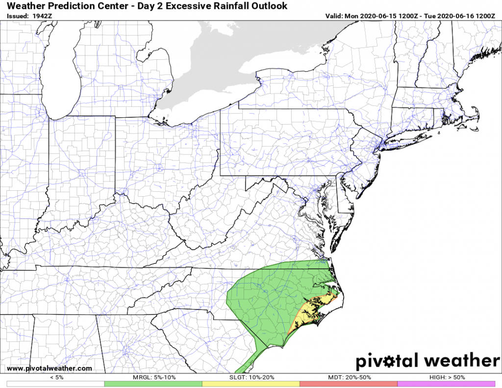
While a flash flood watch is not in effect at this point, you don’t need to be reminded that it won’t take a record rainfall to cause problems, especially after some communities such as Durham and Albemarle dealt with flooding just late last week. Rain will fall hardest on Monday, but will still be in the forecast Tuesday, Wednesday, and possibly Thursday. Thunderstorms look to be confined to the coast, but those could be locally heavy and enhance rainfall as well, hence the slight risk for excessive rainfall.
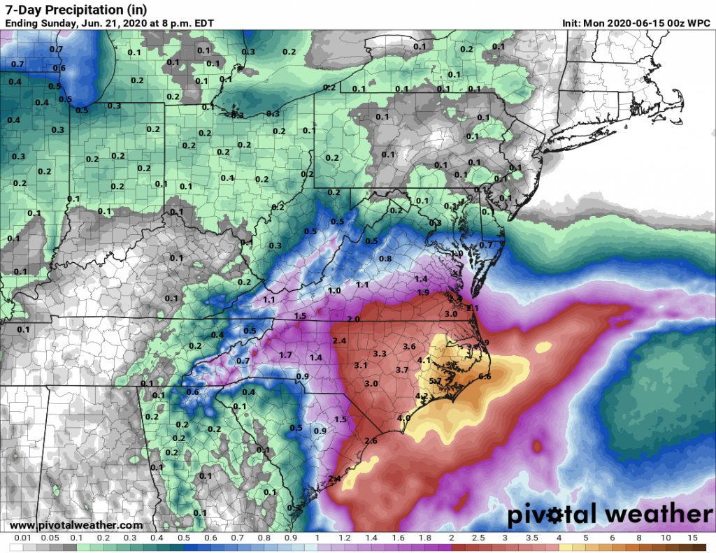
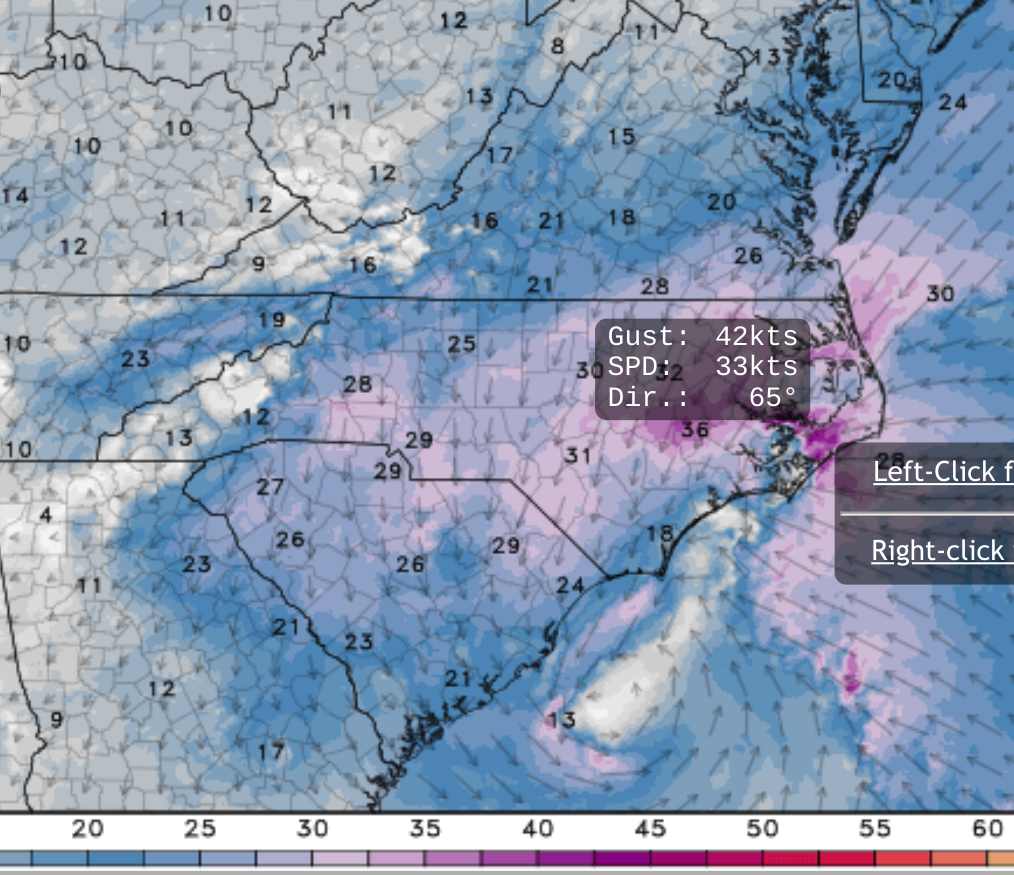
Amounts of rain will pile up in inches this week, with amounts approaching one inch around Charlotte, 3 inches for Raleigh-Durham, and over 6 inches for the Outer Banks. A few of our models show the potential for even higher amounts. Thunderstorms could turn severe at the coast Tuesday as low pressure tracks northward towards Wilmington and then New Bern. Additional storms are possible the second half of the week, but organized waves of severe weather don’t look too possible. With all the water piling on to the coast, winds could gust to 30-40 mph, highest Tuesday evening according to the NAM-3km model below.
Would you believe us if we said there’s a slim chance for tropical development from this low? That would be the absolute worst case scenario from a developing storm over the warm Gulf Stream. Right now, that is probably too far fetched, but stranger things have happened so far this tropical season, so we’ll keep a close watch on it. Even without a named system, 40 mph winds and 6 inches of rain for the Outer Banks will cause enough problems. And this coastal storm is going to set us up for more problems down the road with our expected busy hurricane season.
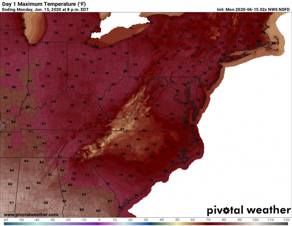
Finally, we’ve talked about some much cooler weather this week. Today looks to be the coolest day, with daytime temperatures in the neighborhood of setting records for lowest daily highs, especially across central and western North Carolina. A few mountain locations may not make it to 60 degrees today! Tomorrow looks cool as well as most places only warm up a few degrees.
Temperatures will slowly warm as we start to see the sun by mid-week, but remain below average through Friday. The good news is that Saturday is the first day of summer, and your beach plans and Father’s Day barbecues will be in better shape as just daytime pop-up showers and storms are expected.

I’ll have a video with more on our YouTube channel. Be sure to subscribe for the latest!
You must be logged in to post a comment.