
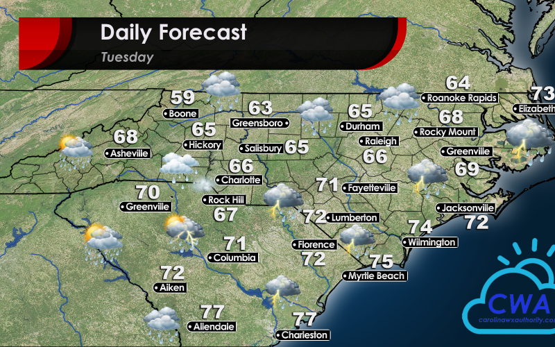
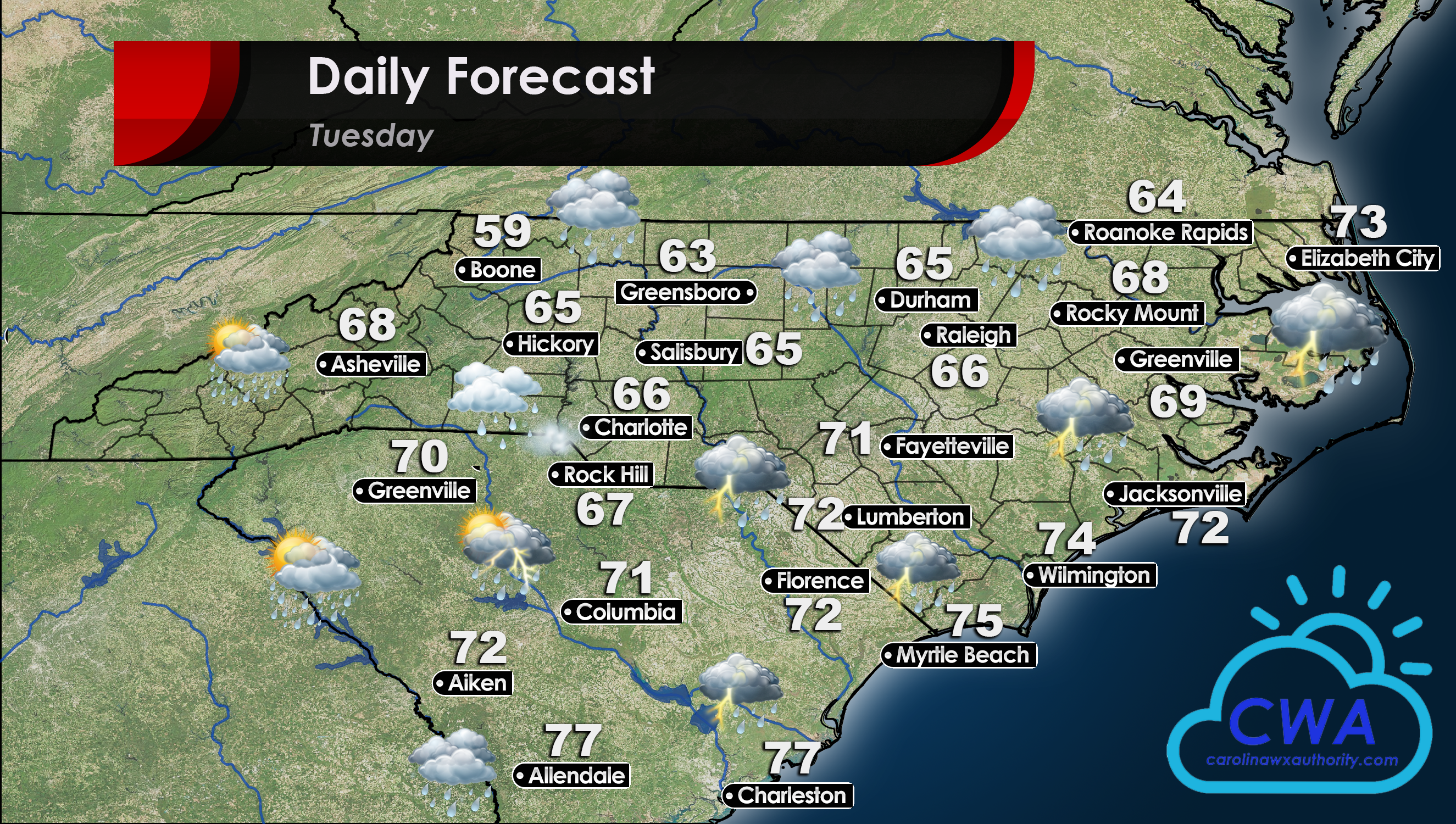
Daily Forecast for Tuesday, June 16th
Precip Forecast: Upper Level Low Continues to Drench Central, Eastern Carolinas
The Daily Forecast for June 16 looks a lot like it did yesterday. Rain showers will continue to be wide spread throughout the Carolinas on Tuesday. The precipitation will be intermittent in the Western half of North and South Carolina. Central NC, including Raleigh, Durham, and the Triad, will see little to no breaks in the rainfall. Coastal areas of the Carolinas will have the best chance of seeing some thunderstorms develop throughout the day, both from the cut off low as well as a subtropical system moving up the SC coast. We are continuing to watch for any potential flooding in the region, although at this time no warnings have been issued.
Temperature Forecast: Spring-like Temperatures Continue, though Warmer Days to Follow
Temps continue to be well below normal for mid June. Enjoy the springtime temperatures while you can though, they won’t stick around for long. Long term guidance is showing a steady rise in temps for the rest of the week. Be sure to follow our Facebook page to keep up with the latest from Carolina Weather Authority!
You must be logged in to post a comment.