
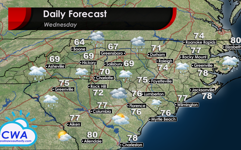
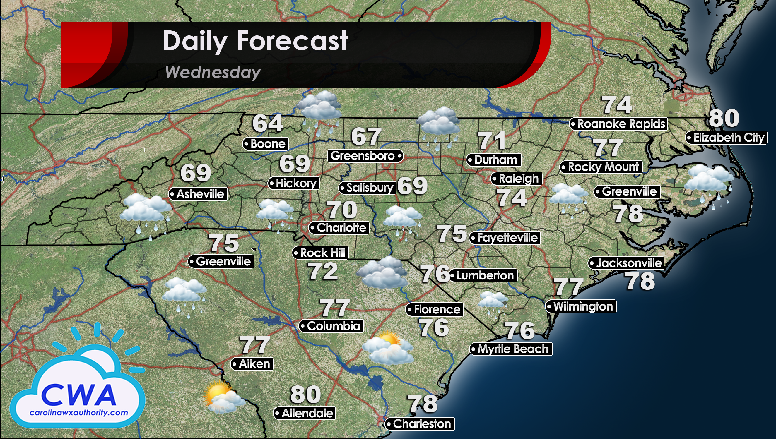
Wet & Warmer Wednesday
An upper level low will continue to dominate the region Wednesday. Thankfully, the low will be moving north and in Virginia by days end. Conditions will continue to be wet and cloudy for all of North Carolina. Temperatures will begin to return to normal, with many areas seeing temperatures 5° to 10° warmer than on Tuesday.
The heaviest rain will be in the Triad region around Greensboro and Winston-Salem. Period of heavier rainfall are still possible, but as the energy associated with the low lifts to the north we can expect a gradual decrease in shower intensity throughout the day.
South Carolina will be the first portion of the Carolinas to see the sun again on Wednesday. As the low lifts north, areas in the far south of the state will have cloud cover around 40%. Florence, Columbia, and Greenville will still have overcast skies unfortunately.
You must be logged in to post a comment.