
This week could be historic for some residents in VA and NC. We are thinking that SC is spared from the worst of the storm, but could still see impacts. At this point we think Florence will approach the coast head-on, but then will take a northward turn before making landfall. How much of a northward turn is unknown at this time. Anywhere from Wilmington to Hatteras are possible locations for a landfall.
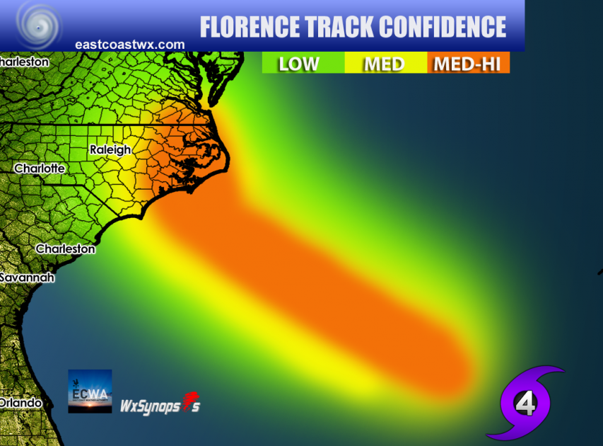
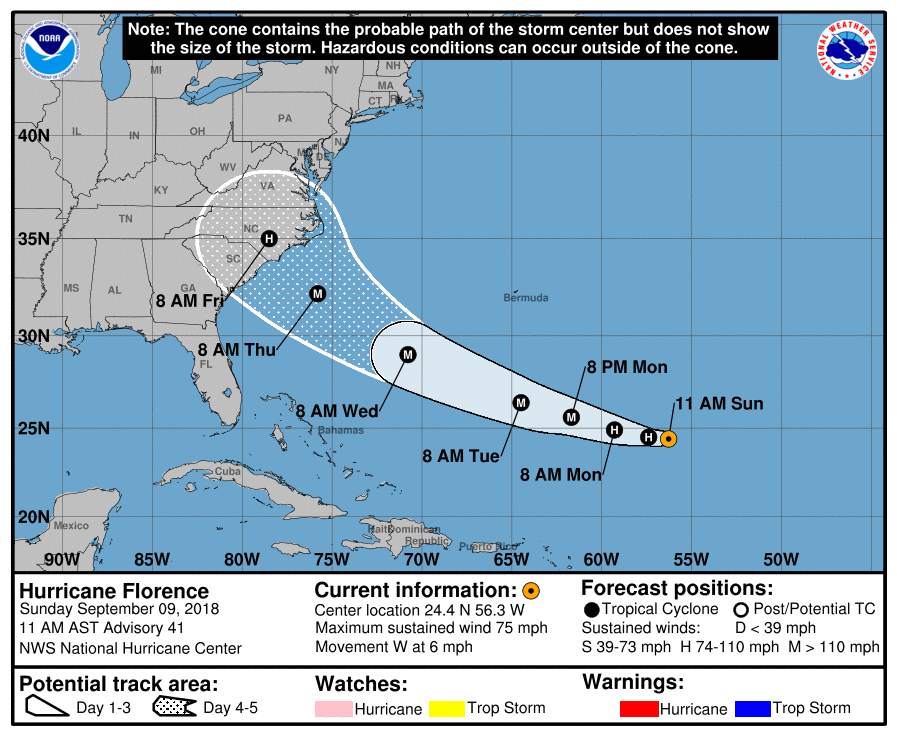
The latest NHC forecast does have a slight northward turn, however much of eastern NC should remain on alert and follow local authorities.
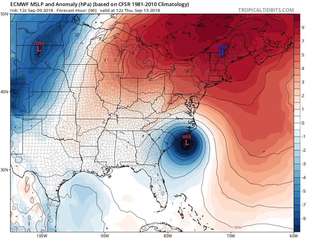
The Euro has been consistent with taking Florence just offshore of southeast NC. It is unclear at this time where the storm will go next. It is possible she will head inland, but also very possible that she curves north after this.
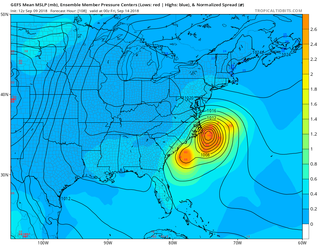
The GEFS ensembles are indicating a strike in eastern NC, perhaps the Outer Banks. However, taking a blend of the models is always a decent choice.
Remember, the trend is your friend, and we could be seeing a trend shifting to the east over the coming days. Please stay with us as we bring you the latest on Hurricane Florence.
-Mike Griffith
Meteorologist
You must be logged in to post a comment.