
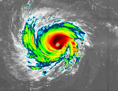
As the clock ticks for a North Carolina landfall, residents should be finalizing preparations and evacuation plans ahead of Hurricane Florence. This is an extremely dangerous hurricane that is at Category 4 strength and was at Category 5 earlier today.
Florence has a well-defined eye and has started a turn towards the northwest.
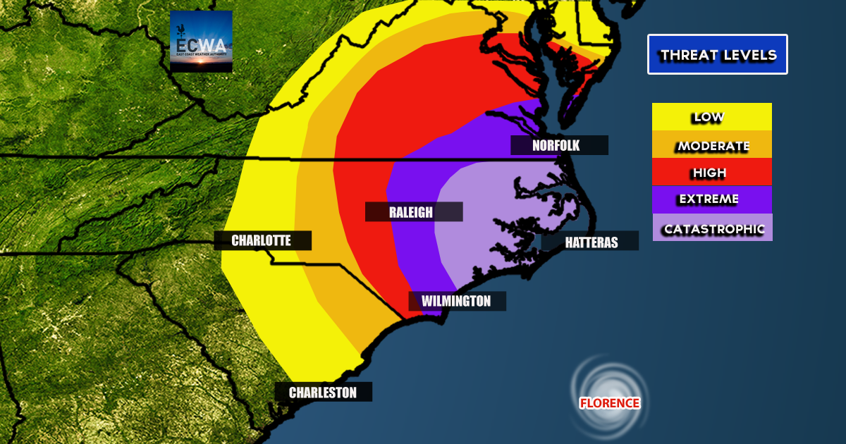
Residents along the Upper SC coast, All of the NC coast, and Southeast VA should be on high alert for this storm and evacuate if ordered by local officials. Do not stay behind if ordered to leave. You could lose your life and put other’s in danger.
Impacts range from low to extreme, however EXACT IMPACTS may not be limited to just the outlined areas. Extreme impacts could still happen well inland depending on the final track.
The Euro model is what has many folks worried, as it plows the hurricane into the NC/SC border as a category 4 hurricane.
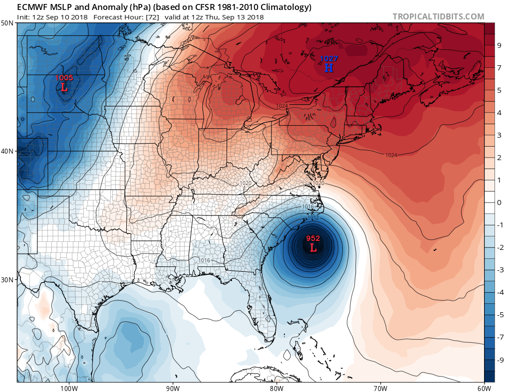
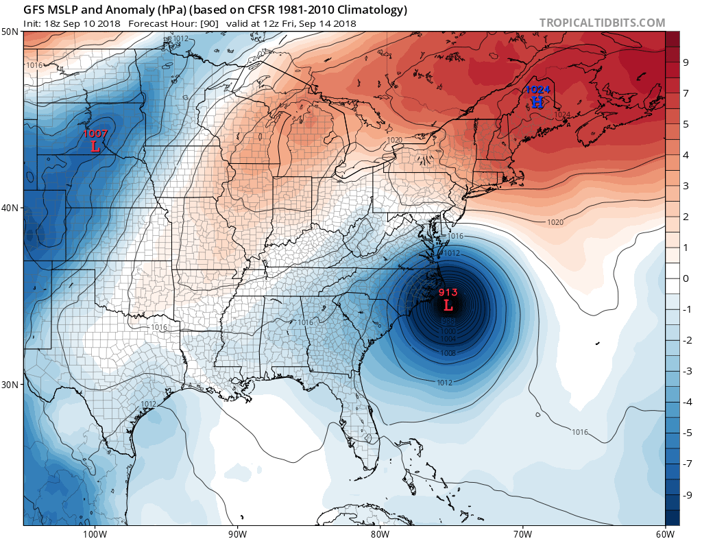
HOWEVER there is still NOT good agreement with the point of exact landfall. The GFS has a CATEGORY 5 hurricane striking eastern NC and this storm could move up to SE VA, so please remain on HIGH ALERT!
Mandatory evacuations are being ordered so make sure to check your local area and heed such orders.
-Mike Griffith
Meteorologist
You must be logged in to post a comment.