
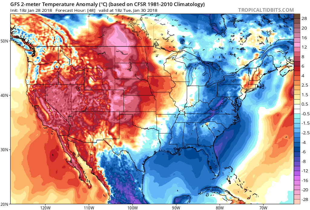
There will be an upper-level disturbance moving through on Tuesday, and even Monday night into Tuesday, which will draw in much colder air behind for many of us on the East Coast. Lows should range in the 10s to 20s for many. Not extremely cold as we have seen before.
Tuesday departures from normal:
Then we look ahead to the 2nd and 3rd of February to a possible winter storm of some sort. It is not clear as to who will see how much snow or who will see snow or rain (or both). We are looking at a more widespread and potent Arctic outbreak form the 3rd to the 5th. Some of the model images are not doing us justice, as they are conservative with the cold. However, we believe that the cold will make it to the East Coast.
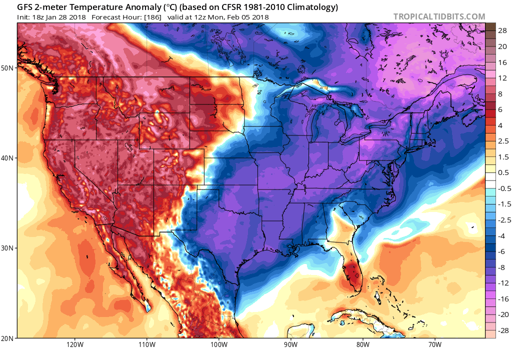
The 30th should be seasonably cold, but then from the 3rd-5th will be below average cold. Get ready for more Arctic chill, after all, it is winter.
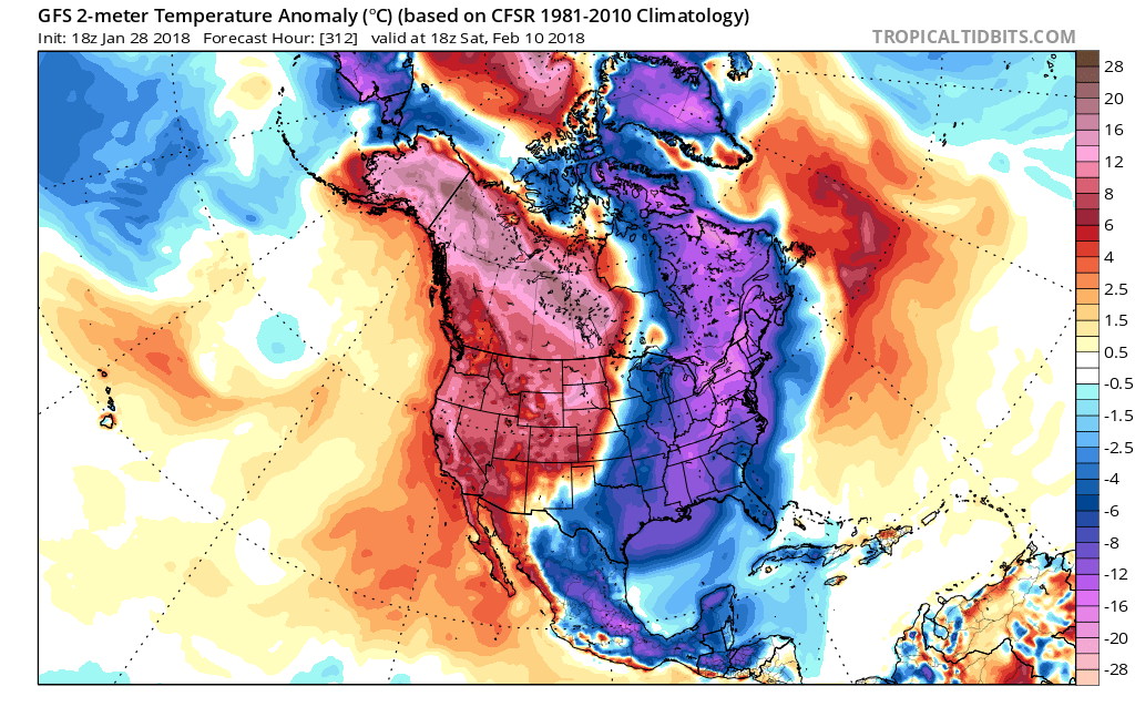
One thing of note, another outbreak is possible around the 10th. This one looks like it could be the most substantial in the near future. This could very well be similar to the severe cold wave we saw in early January, however it will not likely last as long.
Thanks for following and if you liked this, please use the share button below and also to like us on FB if you have not already.
Also if you own a business and need timely and accurate, personalized forecasts or reports, CLICK HERE to sign up for our client services. We offer long-range forecasts as well as short-range to follow you through the storm.
-Mike G.
You must be logged in to post a comment.