
A potent upper-level disturbance will move across the Northeast and Mid-Atlantic region on Monday into Tuesday, bringing with it some light snow. The heaviest amounts are expected to be in central PA. A general 1-3″ is expected across much of PA and MD, and down the spine of the Appalachians down to NC. Elsewhere, show showers and possibly a dusting will be seen in areas closer to the coast.
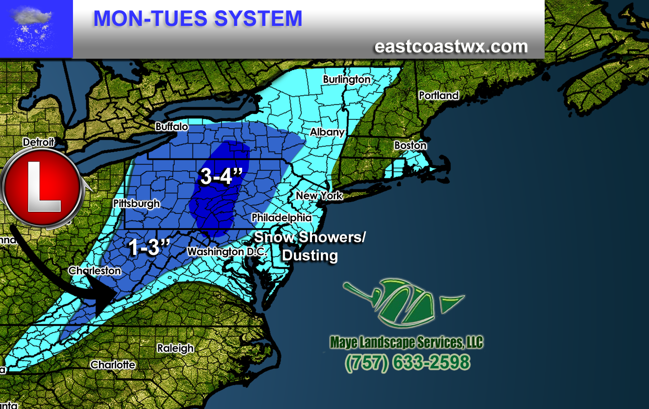
Timing looks like the start is Monday night and into Tuesday morning rush hour. This could make for some tricky commutes in the mountain regions. We’re not expecting heavy amounts with this system. By Tuesday 7pm the system should be gone out to sea.
If you own a business and would like to become a client or sponsor for our services, please Click Here
-Mike G
You must be logged in to post a comment.