
Well, it didn’t take long from us to go from summer right into winter! Well, ok, maybe not that extreme. But we will only be able to experience fall for a little while, then the pattern comes crashing down with a vengeance later this month, perhaps around the 29th.
There is a HUGE trough on the GFS that spills down from Canada, and will bring with it WELL-below normal temperatures. I am thinking the mountains will see some flakes, but exact locations are not yet known. Anywhere that is at a higher elevation and colder than surrounding areas could see their first light snow.
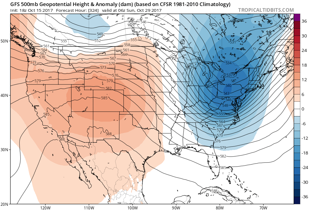
All that blue is easily morning lows in the 30s in the south, and maybe colder in the Northeast!

The GFS at 500mb shows the jet stream taking a huge dip into the Southeast around this time. This could mean that a storm will be responsible for the below normal temperatures, and it could even be a coastal storm!
After temperatures rebound late this week, don’t forget that this cold shot is coming at the end of the month! Think snow for Halloween!
Mike G.
You must be logged in to post a comment.