
After a relatively mild winter, cold air will return to begin March. The coldest air will be in the Plains, however some of this air could make it to the East Coast before the outbreak is over. There will not be any 80 degree heatwaves at least through the first week of March.
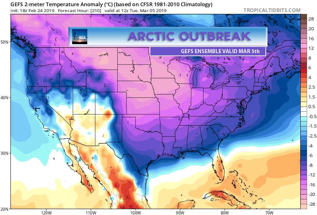
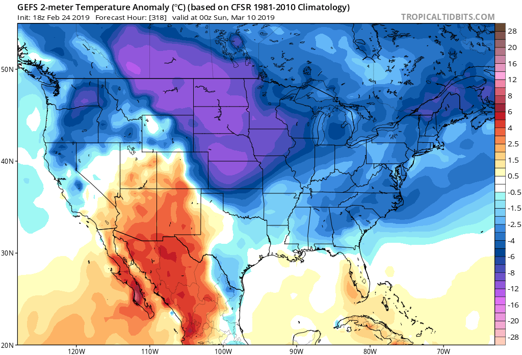
Another powerful cold front will move through the region next weekend, and will bring with it EXTREMELY cold air for this time of the year, especially in the Plains. This will likely be record-setting cold. First hints of the upcoming cold blast start to appear around the 3rd.
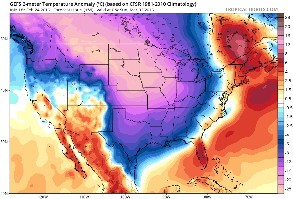
These are all GEFS ensemble means or averages, and the first 10 days of March look below normal. If we have one last shot for snow in the Southeast, it would be during this upcoming timeframe. Any storms are not yet clear as it is too early to tell.
Get ready for what could be a bumpy start to spring with many wild temperature swings!
-ECWA
You must be logged in to post a comment.