
COLD, STORMY PATTERN MATERIALIZING AS EXPECTED; CLIMAX EXPECTED END OF OCTOBER INTO NOVEMBER
Earlier in October, we had alluded to the transition to a colder and stormier pattern for late in the month, and since then we’ve been watching this gradually materialize as the month progressed.
ERODING THE DROUGHT SITUATION:
The drought has been taking a large hit from the various weather systems of recent, such as the tropical system, and various fronts, and yet another storm storm system will follow this weekend with more healthy rainfall. This is the new pattern, and the drought is likely to end completely before long.
THE RECENT EVOLUTION OF THE MADDEN JULIAN OSCILLATION:
The Madden Julian Oscillation (MJO) has played a huge role in the Northern Hemispheric patterns that control our weather. We did anticipate the period from October 23rd through the 31st to be colder than normal. The lag of the MJO moving into phase 2 is likely the cause for delaying more notable cold at times over the Eastern US, including the initial part of that period. However, as previously mentioned, we’ve still begun to witness a noticeable decline in temperatures, which is likely due to some of those teleconnections we talked about beginning to cooperate with our forecast. The MJO is now in phase 2, which will likely soon translate to colder temperatures for the Eastern US towards the end of this month into early November.
THE FUTURE EVOLUTION OF THE MJO AND ASSOCIATED FUTURE IMPACT:
Most of our teleconnections favor a colder Eastern US into early November. The MJO favors a colder Eastern US into early November. Take a look at the latest MJO forecast from NOAA through November 5th:
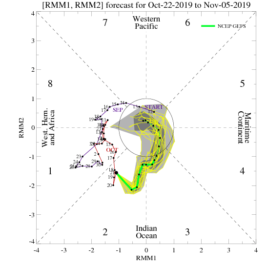
The MJO is in phase 2, but is expected to move into phase 3 in early November. If that does happen, we should see things become noticeably milder for a time around the middle of November. Now this can change, but right now it appears the greatest chance for colder weather will be October 30th through the first 10 days of November, and then we should see it back off for a time. Now how long does it back off? We’re uncertain on that at this time.
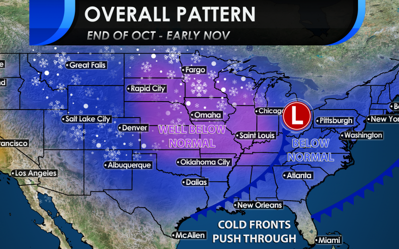
THE TARGET PERIOD AND WHAT TO EXPECT:
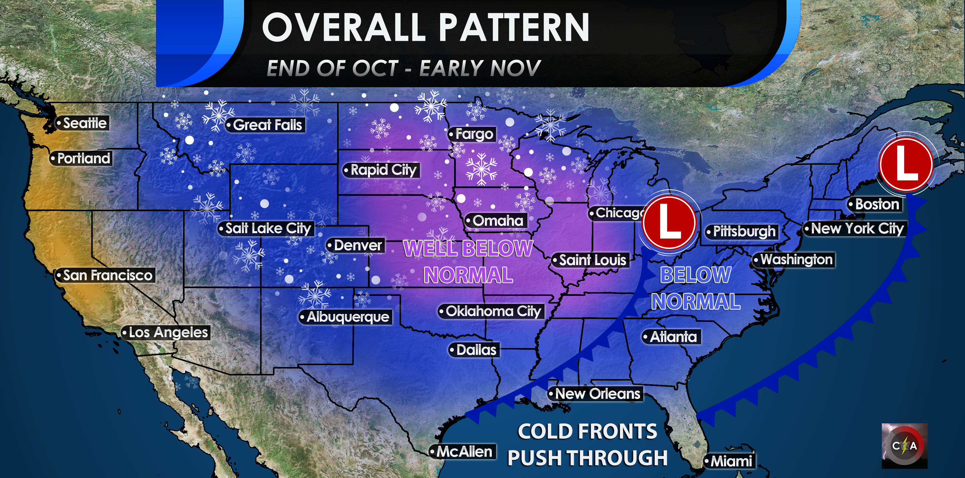
We’re targeting the period October 30th through November 10th for overall colder than normal conditions across the Carolinas, and a continued stormier than normal pattern. A series of cold fronts will likely bring periods of colder than normal temperatures to much of the East in that period. Halloween is still over a week out, so we will be fine-tuning the forecast as we get closer, but it appears to be on the chillier side at this time. Forecast modeling indicates a large trough moving into the Central United States early next week, and swinging into the Eastern US around the 29th or 30th. This should allow for below-normal temperatures for the Halloween period for the Eastern US, including the Carolinas. Depending on the amplitude and evolution of the trough, there could be some unsettled weather on the front end of it, which may dampen some Halloween activities. Again, timing and evolution will have to be pinpointed as we go on to determine if there is any precipitation to affect holiday plans. Furthermore, with the overall pattern, be on the look out for a colder storm system or two in this period we outlined that could bring about snow in the higher elevations, and possibly areas north of the Carolinas, and very cold rain for other areas. The high-latitude blocking and phase of the MJO favor this potential, so we will be watching. It’s not out of the question that something like this happens near, or just after Halloween in early November.
We will be watching the large-scale pattern closely in the coming weeks, and adjust accordingly on this forecast, and carefully monitor the remaining autumn season going into winter. Stay tuned here on the site and on social media for the latest information.
-Jesse
Carolina Weather Authority.
You must be logged in to post a comment.