

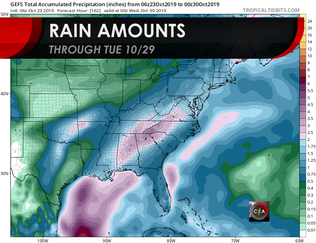
RAIN RETURNS
The Gulf will be open for business once again, and will cause moisture to stream over western parts of our area starting late Friday and into Saturday. Rain will overspread primarily western areas of NC and SC by Saturday morning. Sunday will also be another dreary, damp day with off and on showers. This pattern will persist into next week before a powerful cold front drops our temperatures by Halloween. Rain will be heavy at times and also off and on in spots. Don’t count on staying completely dry from Friday into next Tuesday. The next 6-10 days or so are forecast to be above average precip-wise here in the Southeast.
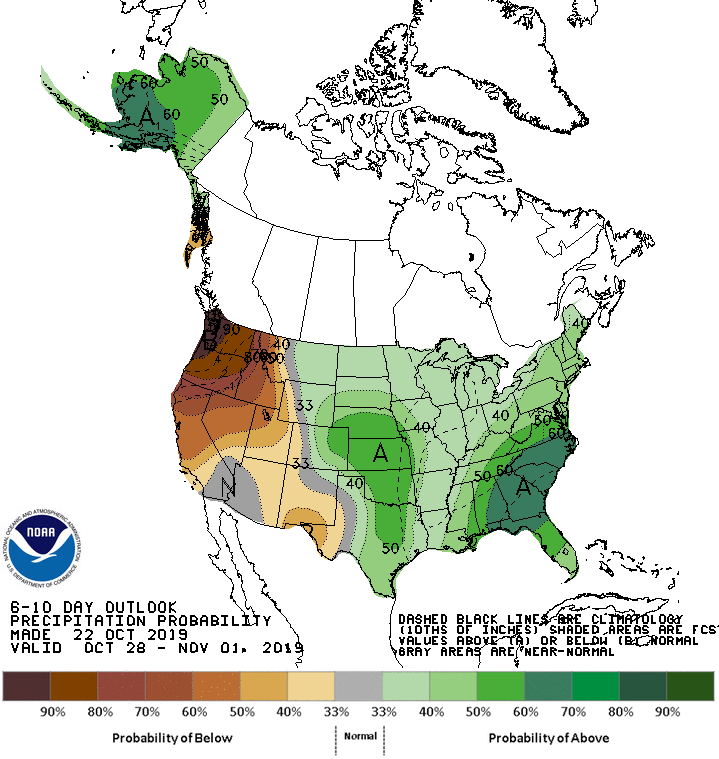
In fact, the Climate Prediction Center paints us for a high probability of a wetter than normal pattern through November 1st. This will likely be due to a disturbance in the Gulf that will pump moisture our way.However, we will have a dry Halloween after a cold front pushes through on or around the 30th. This will be beneficial for most areas as we are technically still in a drought. Most of this moisture will come ahead of a powerful cold front that will drop our temperatures for Halloween to below average and into early November. Check out our article that covers this topic here: Cold Pattern Shaping up for End of Month; Early November
Enjoy the sunshine today because it is going away for a bit! We will be updating our Models Page very soon with winter material.
Thanks for reading and please share with others!
CWA
You must be logged in to post a comment.