
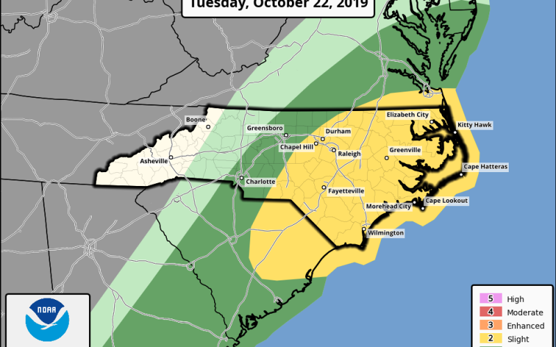
SEVERE WEATHER EXPECTED ALONG AND EAST OF INTERSTATE 85 TUESDAY; TORNADO RISK IS ELEVATED
A cold front that has been pushing east through the Deep South Sunday into Monday will bring lines of showers and thunderstorms on Tuesday, with a severe weather potential for the eastern half of the Carolinas. If you remember our previous long-range discussions concerning the unsettled pattern in late October, we had addressed the future potential for severe weather with some of these troughs digging into the eastern half of the country. Indeed, we now have a window of opportunity for such for Tuesday, with the primary emphasis in the Central, and especially Eastern Carolinas.
STORM MODE AND RISK ASSESSMENT:
Severe weather is not expected to be completely widespread, but scattered areas of severe weather are most likely in the eastern half of the Carolinas, in comparison to the western half of the Carolinas. Storm mode should primarily be quasi-linear, meaning storms should congeal into squall lines, which are stereotypical of cold frontal passages such as this one. The greatest severe weather threat with these types of convection is generally wind, so high wind gusts will be possible tomorrow across the Central, and especially Eastern Carolinas. Cape values aren’t overly high, but are present, and wind shear should allow for severe weather development. While the storm mode will mainly be quasi-linear, discrete super-cellular development cannot be ruled out, and our short range modeling does indicate this to be slightly possible. Therefore, there is a small tornado risk present from I-85 eastward, and a greater risk along and east of I-95, where modeling indicates super-cell composites and tornado parameters are the greatest. Additional minor concerns would be downpours and localized flooding, but the flood threat looks minimal with this system.
CITIES POTENTIALLY IMPACTED:
Cities possibly impacted by severe weather include Charlotte and Greensboro, North Carolina, and Charleston, South Carolina. Cities most likely to be impacted by severe weather include cities like Raleigh, Durham, Fayetteville, Wilmington, Elizabeth City, and Cape Hatteras, North Carolina, and Columbia, Florence, and Myrtle Beach, South Carolina.
TIMING:
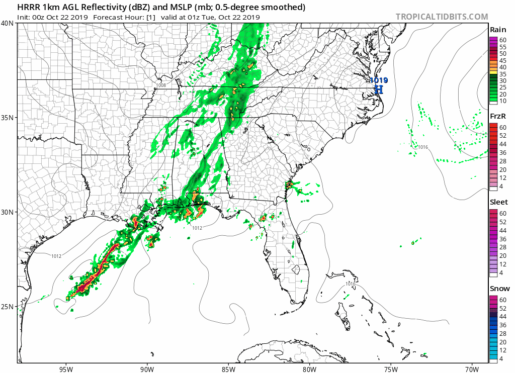
Short range modeling differs on timing, but best estimation would put showers and storms (mostly non-severe) in the Western Carolinas in the morning through early afternoon, and in the Central and Eastern Carolinas primarily for the afternoon and early evening hours, where the severe weather threat is more elevated with the heating of the day. The high-resolution HRRR short range model seems to have the best idea on timing:
Make sure to have a way to receive all watches and warnings, and stay tuned to Carolina Weather Authority on the site, and Facebook and Twitter, for the latest on potential severe weather for Your Tuesday.
-Jesse
Carolina Weather Authority
You must be logged in to post a comment.