
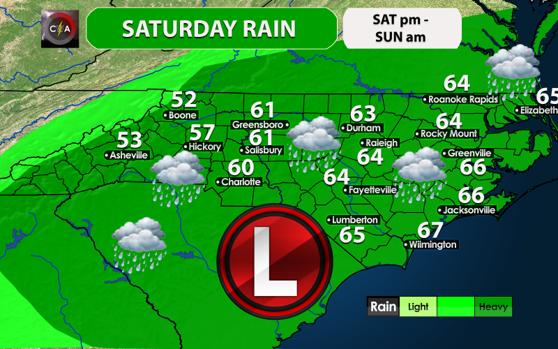
As tropical storm Nestor makes his transition to a subtropical storm across our region, rain will overspread our area today anywhere between 3 and 6 pm, and will last through Sunday morning. Any outdoor plans will have to be rescheduled and/or canceled. Highs will not get out of the 50s in western locations and will hover in the low 60s across the Piedmont. The winds will also pick up, and could gust to 50 mph in spots resulting in scattered power outages, especially along the coast. Also tornadoes are a threat east of I-95! Places inland could also see power outages from the heavy rains and gusty winds. It will be a rather foul day overall for most across the Carolinas. This storm will move out quickly, and Sunday should clear up later in the day!

You must be logged in to post a comment.