
After what was a very humid and damp week, next week will be much drier and cooler. Temperatures this week were warmer than average, and then the leftovers of Hurricane Eta made their way to the Southeast. Fortunately, conditions have improved this weekend as a cold front pushed through last night and took all of the heat and moisture with it.
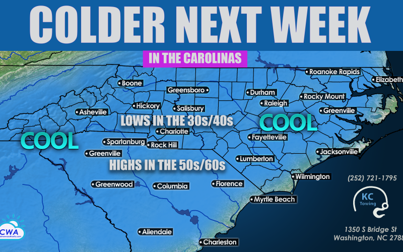
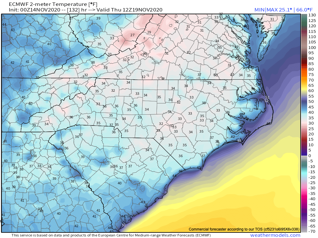
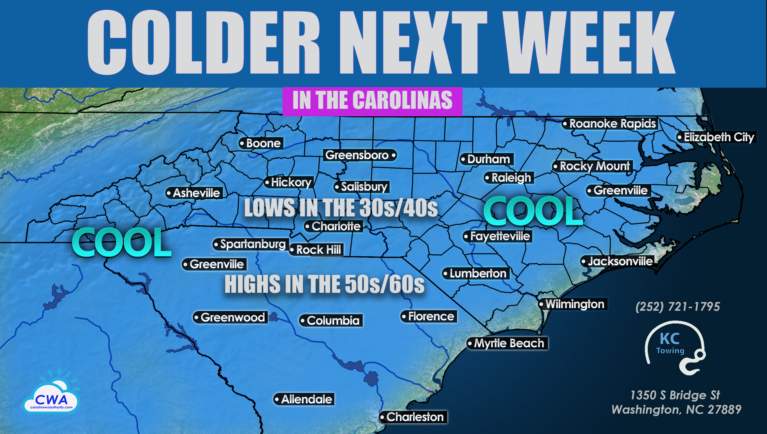
As we head into the new week, temperatures will take a tumble. The coldest night of the upcoming week looks to be on Thursday morning, with lows in the mid 30s. Wednesday morning will be right behind, with lows in the upper 30s. There are some locations closer to the coast that will see lows in the 40s.
As for highs, on the days with the coldest mornings many of us can expect to see highs in the 50s, but as things warm up our highs will slowly climb back into the 60s. Of course, along the coast, we can expect to see readings in the higher end of these temperatures.
Shown below are Thursday morning temperatures at 7am.
Overall, expect cool crisp mornings next week across the Carolinas, with pleasant daytime conditions, including abundant sunshine and perfect November temperatures. Many will see morning lows in the 30s and 40s depending on location, and also highs in the 50s/60s depending on location. The higher end of these numbers will be more likely as the week progresses.
Everyone ENJOY your weekend and be sure to watch for updates from Carolina Weather Authority! Have your friend and family like us on Facebook ~~> https://www.facebook.com/carolinawxauthority
You must be logged in to post a comment.