
Hey Everyone! We are back after a couple of weeks off due to business travel and overall weather inactivity. So what’s cooking? Really not a whole lot, other than a storm system coming up the East Coast around next weekend, February 2nd. However, for the Southeast and the Carolinas, it is expected to be all rain. Temperatures will only be marginal for this event, and may even turn up mild before and after the storm. However, we are watching a bit more of a cold outbreak around the 5th or so.
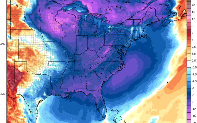
The GFS and the GEFS have much cooler temperatures moving in around the 5th and 6th below.
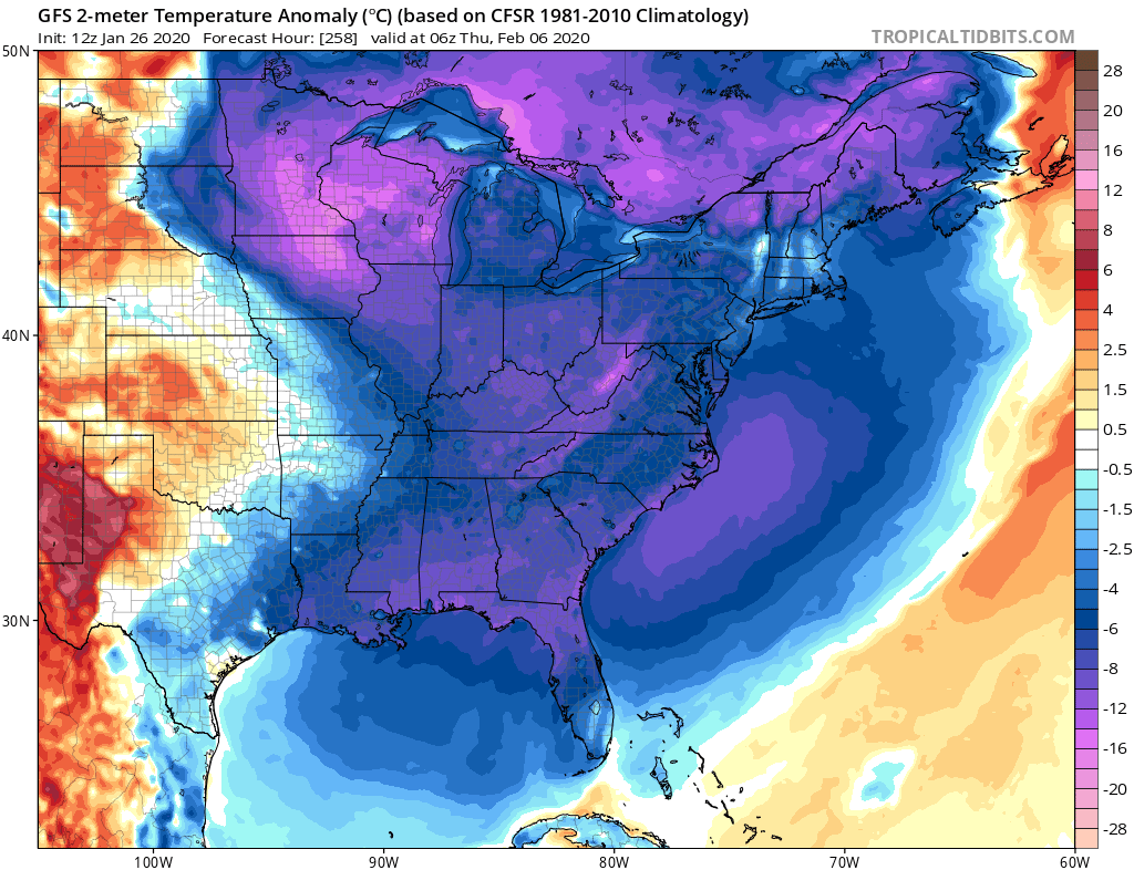
What does this mean for overall temperatures? Low temperatures are expected to be quite cold, and we could see another cold snap makes its way down into Florida. Will there be more iguanas falling from the trees? We don’t know, but it appears that the Deep South will not be able to escape sub-freezing temperatures this time either.
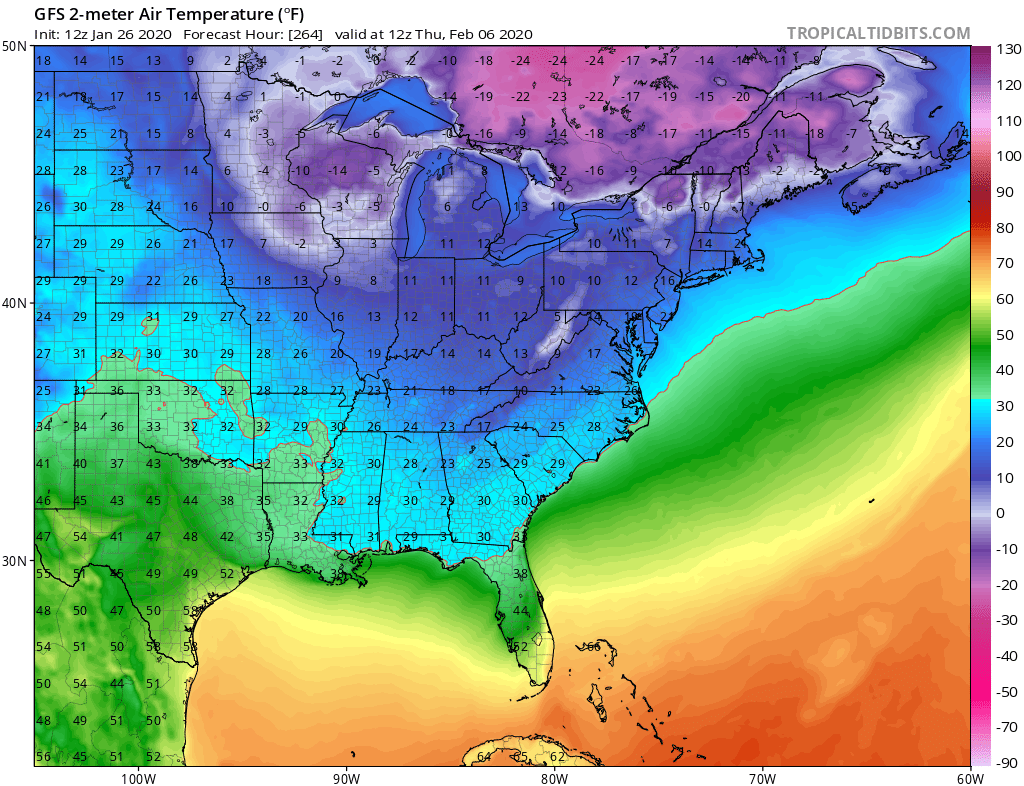
Shown below are the morning lows for Friday February 6th. These may not be EXACT lows, and this can change, but we’re just trying to illustrate that another southern Cold Snap could be coming soon.
The chill looks like it may stick around for a bit, but it will be followed by a warm up, as every cold shot has been so far this winter. Now there is something showing up on the GFS just after the above cold shot, but we will wait for more model consistency before posting about it.
Extremely frigid air may take over the Central US around the 11th or so. This could be some of the coldest air so far this season for them. Does it make it our way? Stay tuned!
-CWA
You must be logged in to post a comment.