
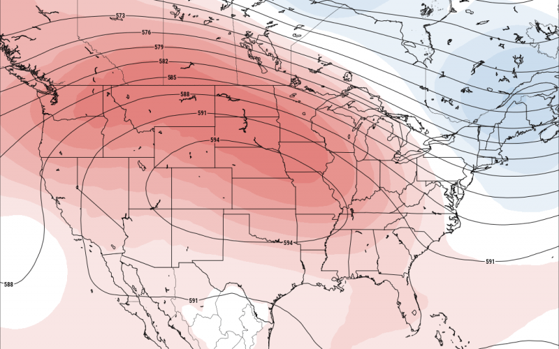
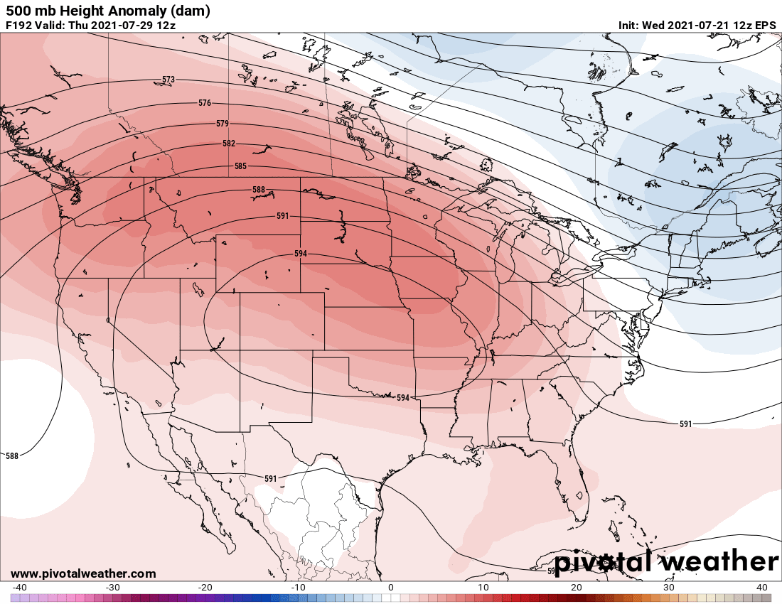
There is talk about a potential heat wave next week for much of the central and eastern half of the U.S. Where the heat dome, or upper ridge of high pressure will determine who will see the hottest stretch of days. There may be backdoor cold fronts that will continue in New England, especially Maine where they have seen frequent frontal passages. The Northeast from PA up to Maine might have immunity from the upcoming heatwave according to the Euro ensemble mean below:
High temperatures in the lower to mid 90s are possible from the central US to the East Coast by Wednesday through Friday next week. This is currently a week away. If this verifies, the daily rain should dry up and temperatures will rise daily. This is typical for late July and early August.
The severity of this heatwave for us will depend on the exact placement of the closed center contour in the model image above, and also how far south the Northeast backdoor cold fronts make it. We can expect slowly climbing temps here in the Carolinas, and we could hit 95 at some point.
Let’s see if this pans out.
You must be logged in to post a comment.