
While there is no immediate tropical threat, as no form has formed yet, there could be a couple areas of activity that need to be watched over the next week or two. Indications are that tropical activity will slowly start to increase this time of year. While any details such as landfalls or intensity of a storm are unknown, the overall trend will be a slow increase with tropical disturbances once again.
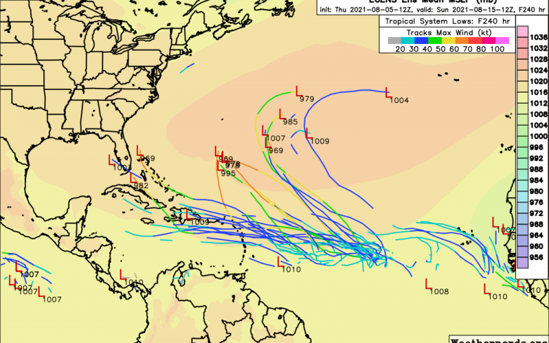
The below Euro ensembles show potential storm tracks over the next 240 hours. Note that the general trend off Africa is for storms to turn north out to sea. However the Caribbean may see some tropical waves or tropical storms. But the more southerly and westerly track may be areas for concern around mid-month.

We are not saying anything about hurricanes at this point, since they have too many details that are not known at this time, plus it takes a lot of energy for a hurricane to form way out over the Ocean.
But the Gulf is a different story. Stay with us, and be sure to share this article on FB!
You must be logged in to post a comment.