
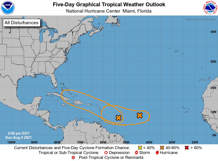
Good Sunday afternoon! Well, the tropics are trying to come to life suddenly with multiple disturbances in the Atlantic. Currently, Invest 94L is the leftmost orange one, which has a medium 50% chance of formation over the next 5 days. Invest 94L is what will have to be watched for any potential land impacts, including here in the U.S. But that is still too early to tell. If anything, it appears for now that the Caribbean could be up next for tropical storm conditions. With the two given orange areas below, their track and strength will need to be monitored, which they will be.
Per the NHC regarding Invest 94L:
1. An elongated area of low pressure located several hundred miles
east of the Windward Islands continues to produce disorganized
showers and thunderstorms.  Environmental conditions are expected
to be favorable to support some gradual development over the next
few days, and this system could become a tropical depression while
it moves west-northwestward at 10 to 15 mph.  The disturbance is
forecast to reach portions of the Lesser Antilles late Monday, and
then move near the Virgin Islands and Puerto Rico on Tuesday, and
near Hispaniola around the middle of this week.  Interests in those
areas should monitor the progress of this system, as it could bring
locally heavy rainfall and gusty winds to portions of that area.
* Formation chance through 48 hours...medium...40 percent.
* Formation chance through 5 days...medium...50 percent.
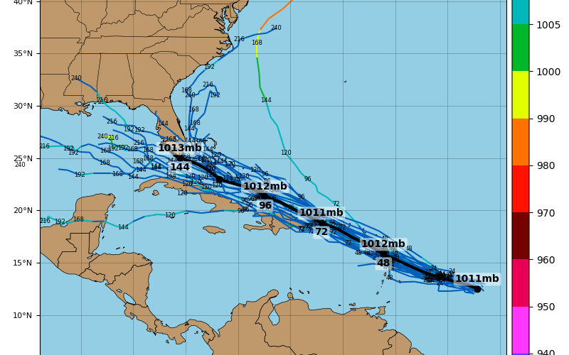
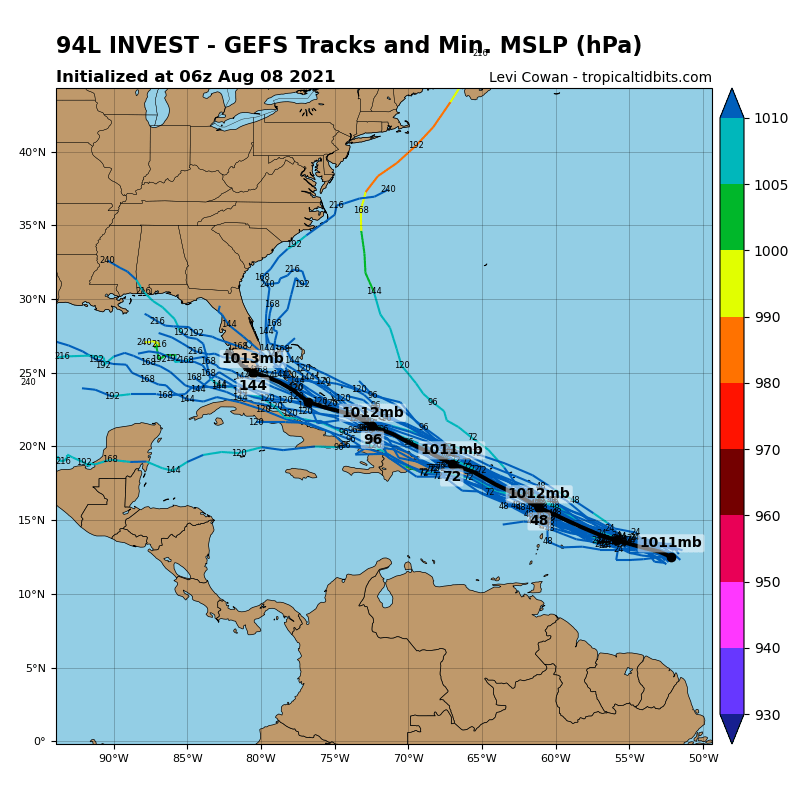
However, the GEFS spaghetti plots do appear to be ominous right now for Florida. But we can’t just focus on that, we also might have to consider a Gulf entrance. But a cluster of the models below takes 94L right into south Florida, perhaps as a tropical storm. We will have to see if this shifts westward over time or if the intensity will change,
Without speculation, all we can do for now is monitor this storm to see if it develops. Then we might have a better idea where it’s headed later this week. NO WORRIES for now! Enjoy that beach vacation or wherever this week, since there is no immediate threat. Just have to watch this one!
You must be logged in to post a comment.