
As Fred gets going once again in the Gulf, the Florida Panhandle will need to watch in case Fred makes it to Category 1 hurricane status. This is a possibility given how warm the Gulf waters are. Overall, expect the severe storm threat to continue into Tuesday for the Carolinas. We are already seeing the moisture being pumped up from the South, and here in South Charlotte I had hail and damaging winds at my place yesterday. Lots of damage in my area.
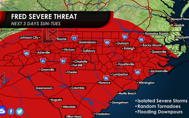
Here’s our latest graphic that shows where we think damaging winds and tornadoes are possible with Fred. Storms will generally move from southeast to northwest.
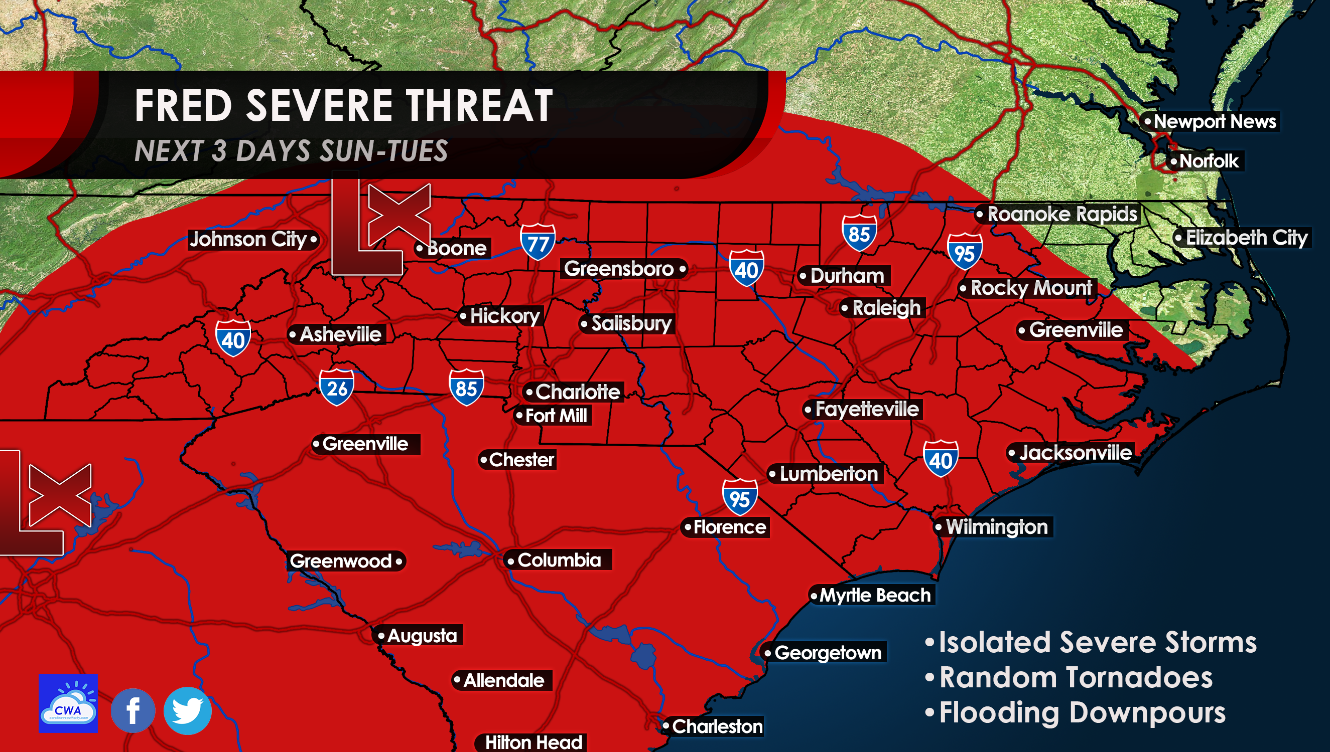
As per the graphic above, anyone in the red can see a severe storm, tornado, flooding downpours, or any combination of the three. If you have the option to work from home, the next couple of days will be good days to do so. Interstate travel could become dicey with flooding rains and poor visibility.
Here are the rains expected from Fred:
Mainly west of Charlotte in the foothills and mountains is where the rain is expected to be heaviest. The rains above are for Fred and do not include our daily showers and storms. Overall precip amounts will be higher with the addition of Fred’s totals above.
Plan for worsening weather through Tuesday in the western Carolinas, and everyone be on alert for tornadoes!
You must be logged in to post a comment.