
As we dive into June 2020, it has been refreshing when the month first started, however now things are getting a bit more humid and the air thick when we step outside. This trend will likely continue through this weekend and even into some of next week, but by mid-month there will be another refreshing airmass descending over the East Coast.
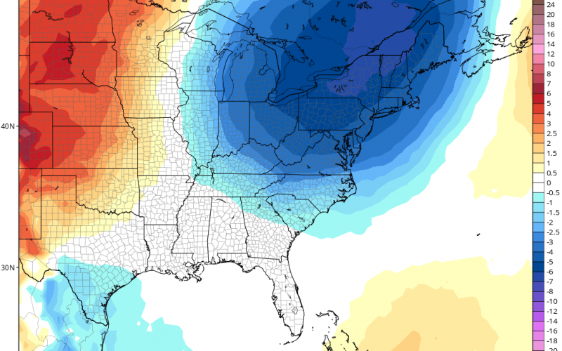
Below is the Euro ensemble mean output for temperature anomalies for June 14th.
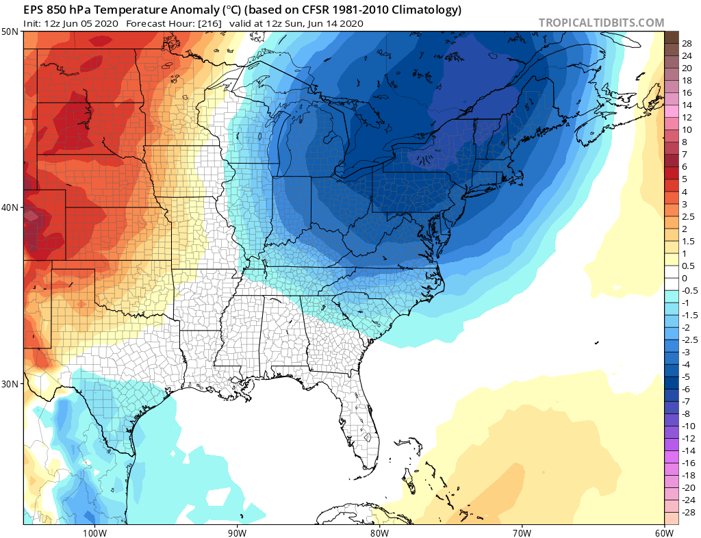
All of the heat will seemingly be focused out West. In turn, this means that the East will see a trough, which comes with cooler than normal temperatures. Alas, there is no major heatwaves in sight other than some normal June heat this weekend and into next week.
In fact, the temperatures in 8-14 days from now appear to have a favorable chance of being below normal for the eastern third of the U.S. The heat will remain in the Heartland but may be squelched by another trough moving into the West, but we shall see.
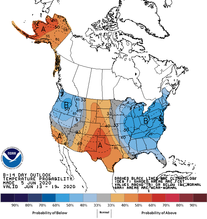
In other words the good news is that there is no sign of any upper 90 degree days, so we may save a bit on our a/c bills here in the South and elsewhere.
Keep it here at CWA for the latest!
-Mike
You must be logged in to post a comment.