
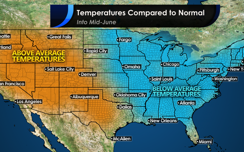
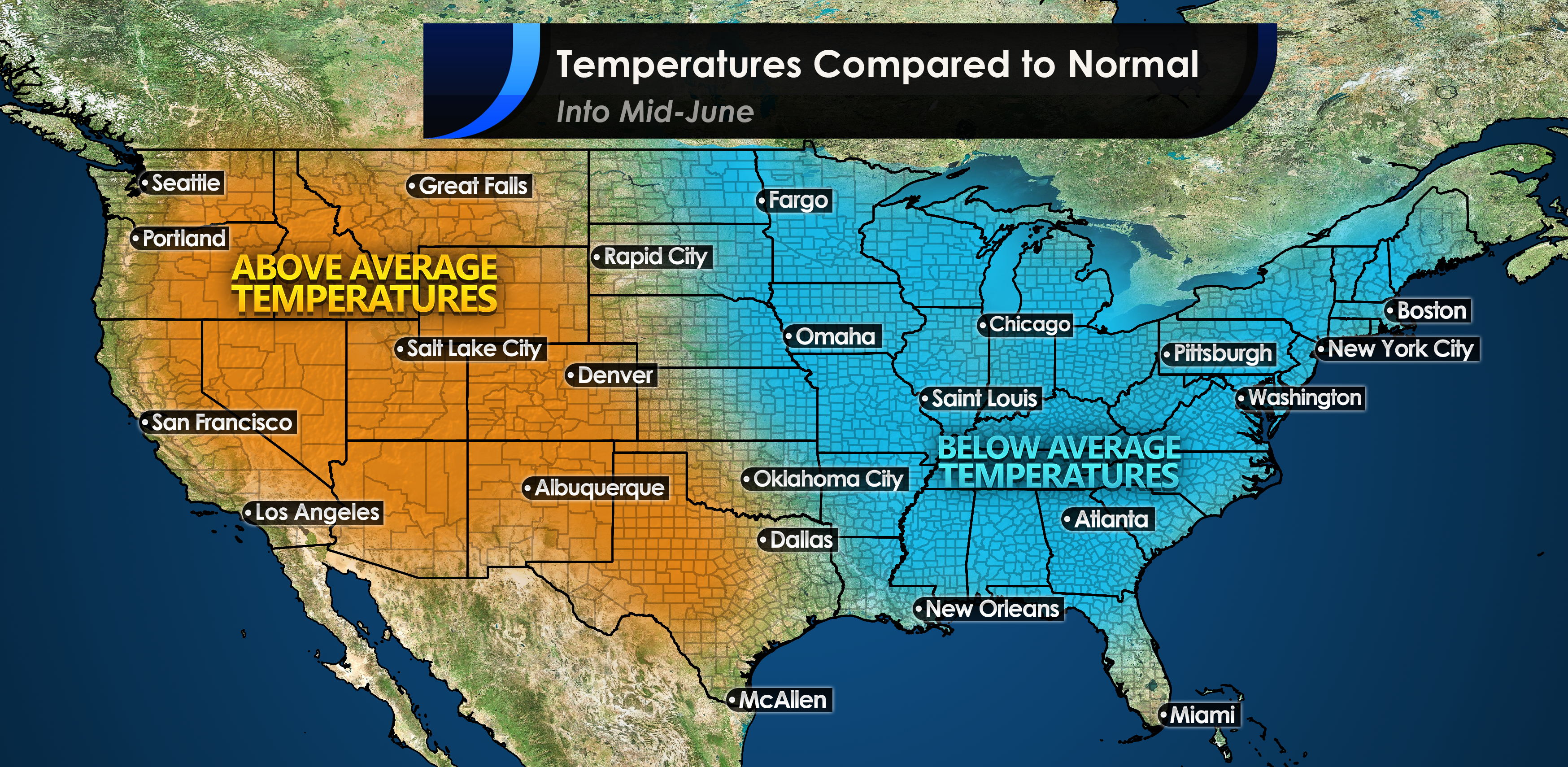
As Cristobal makes landfall along the Gulf Coast this weekend, his effects will actually be welcomed in most places down the road. But not in the way that most of us will think. His flooding rains and high winds this weekend will not be welcome in such places as the Gulf Coast States. However, he is forecast to move northward and eventually up into Canada as a post-tropical disturbance. He will then affect the jet stream in such a way as to make it dip over the East Coast.
A cold front will swing through our region mid next week, and will cool us off considerably as the remnants of Cristobal get caught up in the jet stream. Once this front moves through, we will remain cool into mid-month, and we can expect to be cooler than average for this time of year. Out West will continue to see hot temperatures, and likely more 100s in the Desert Southwest.
It is not clear how long this trend will last or if we will go back to more summer-like temperatures before the end of June. If you saw the latest 3-4 week outlook from the CPC, they had the ENTIRE COUNTRY painted in orange or above normal.
We do not think that will be the case here at CWA, at least not for now. We will have some warm and sticky days from this weekend and into part of next days, but next weekend will be much cooler, and may even feel fall-like.
You must be logged in to post a comment.