
After a very wet second half of May, the first ten days of June featured below normal rainfall for many of us, but our wet summer forecast looks to be back on track later this week. A powerful cold front currently over the Plains will move into the Carolinas Wednesday night, producing some locally gusty thunderstorms with it.
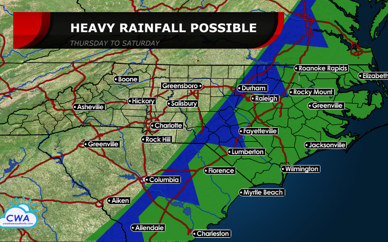
As the front moves east past Charlotte and Greensboro Thursday morning, it looks to quickly put on the brakes. A strong region of high pressure well off the East Coast will flex its muscles and block the path of the front, perhaps well into next weekend. That will unfortunately spell a much wetter pattern for the eastern Carolinas Thursday through Saturday. A few models keep this front in our neck of the woods into possibly the beginning of next week, meaning both days of the weekend could be spoiled at the beaches.
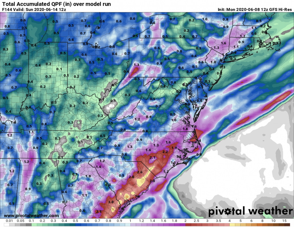
Both medium range models that we use to make our forecasts show widespread 1-2 inch rain amounts along and east of U.S. 1, with some locally heavier storms. While the cloud cover and weak winds aloft will limit organized severe weather, we have to again prepare for area rivers to slowly climb.
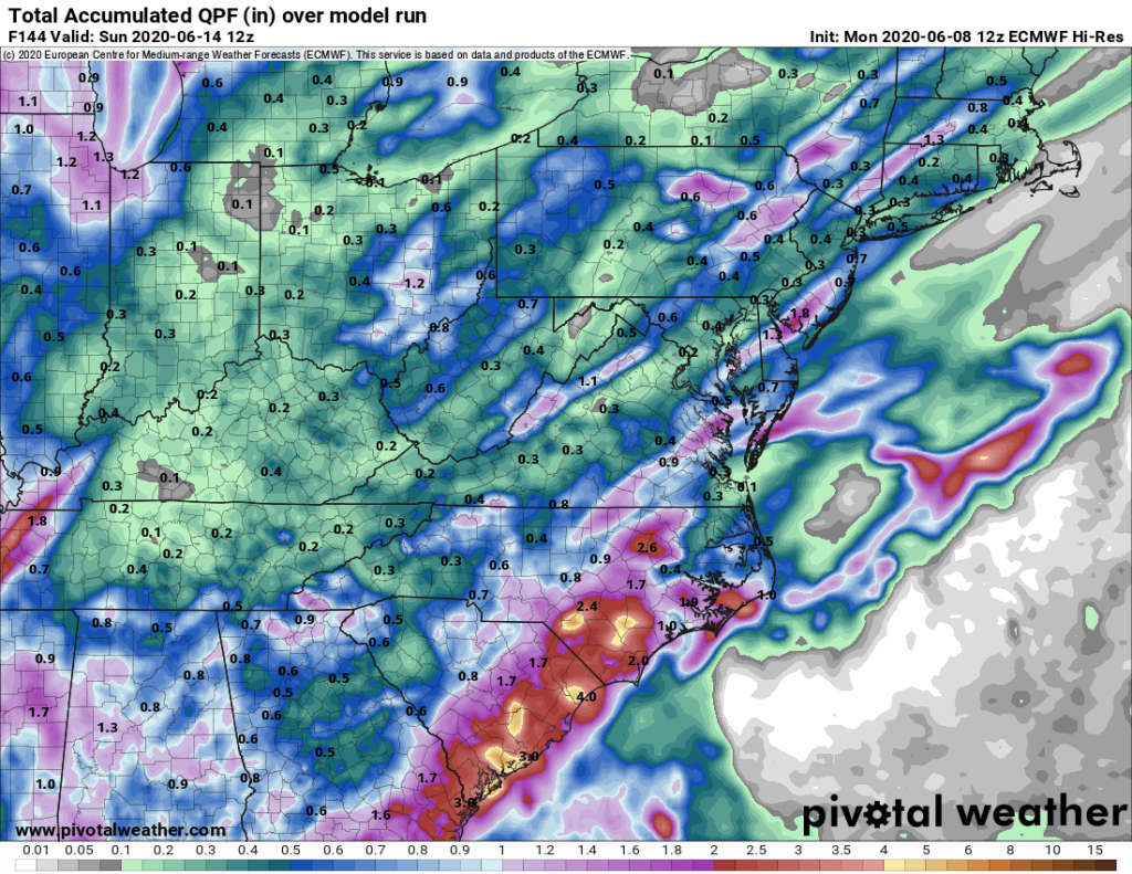
As is common with these models, there is a lot of margin of error, and with the threat for locally slow moving showers and storms, the error may end up being that MORE rain falls than currently depicted. With very humid air in place, expect a few locations to total 5 inches of rain through Sunday morning. If the front is even slower, that amount could go up. Some tropical moisture remaining in the wake of Tropical Storm Cristobal will feed northeastward along the stalled front into our neck of the woods. We believe widespread flash flooding isn’t too likely, but some places could end up with local river and creek flooding after 3-4 more days of rain.
Stay tuned to our latest updates as this situation evolves. We will also be posting daily video updates on our YouTube channel and Facebook page. Please subscribe to both if you already haven’t.
You must be logged in to post a comment.