
Pop-up Thunderstorm Threat Monday
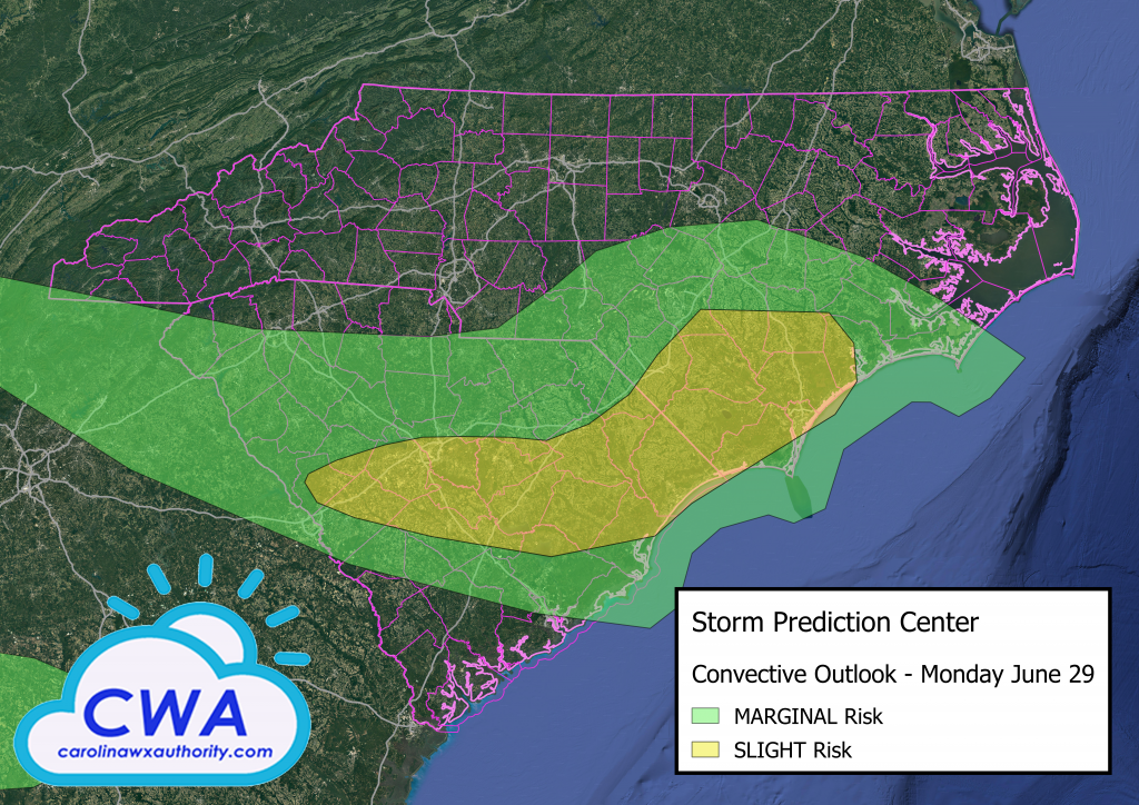
Happy Monday to everyone! Monday’s weather continues the classic summer pattern in that nearly all areas will have a risk of seeing a pop-up thunderstorm. Thankfully, we do not expect widespread thunderstorm development. Most locations have a 20% chance, or less, of seeing any kind of storm development. Here is a look at the Storm Prediction Center’s outlook for Monday:
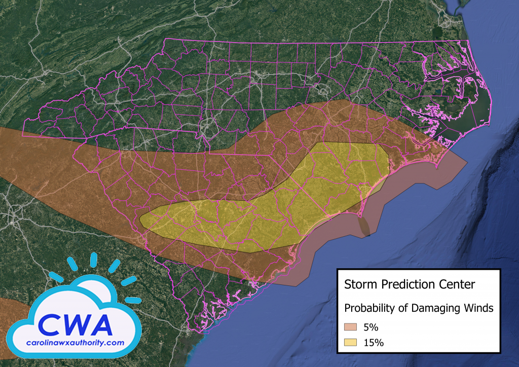
These storms, besides dumping large amounts of rain in a short period of time, can also generate damaging winds in excess of 55 MPH! The SPC has determined the following locations have a 5%, or greater, chance of experiencing these kinds of winds. You can always check the Carolina Weather Authority’s Model Page for the latest information, including radar and forecasts!
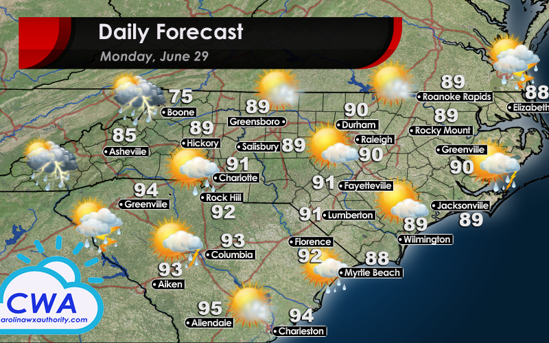
Besides the threat of pop-up thunderstorms, expect Monday to be muggy and hot. In North Carolina, temperatures will be around 90°F. In South Carolina, temperatures will climb higher, into the low to mid 90s. Moisture advects into the area Monday morning. This serves to increase the relative humidity and make it feel much hotter outside. Be sure to stay hydrated if you are working outside! When it comes to lightning safety, never forget that if you can hear thunder, you are already close enough to be struck by lightning. Stay safe out there Carolina!
You must be logged in to post a comment.