
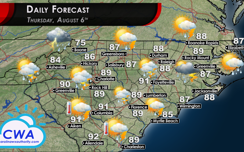
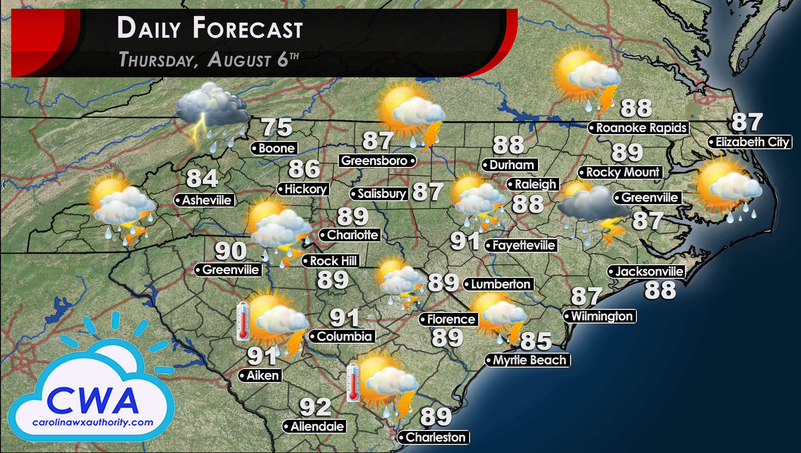
Daily Forecast for Thursday: Unsettled & Stormy
Every location in the Carolinas has at least a 30% of seeing some thundershower activity on Thursday. This is largely thanks to an upper level trough that will slide through the region during the day. This system will cause an increase in vertical shear, which is something that thunderstorms love.
As such, the Storm Prediction Center has placed all of NC & SC under the lowest threat level for storm activity. A slice of Central and Western NC, along with a small chunk of northwestern SC, is under a marginal risk (the next threat level up).

Besides the atmospheric dynamics being favorable for storm development, the temperatures are also creeping back up. If you don’t see any rain Thursday, you can expect temperatures to be around 90°F. The later in the day that we start to see storm development, the better chance that some of those storms may become severe.
-CWA
You must be logged in to post a comment.