
Daily Forecast for Tuesday, July 14th, 2020
Happy Tuesday Carolina! I have good news and bad news for the Daily Forecast for Tuesday. Let’s get to the juicy bits!!
Daily Forecast for Tuesday: Precipitation Chances

The daily forecast for Tuesday has very little in the way of rain chances! As usual, there are still chances for pop-up thunderstorms, but most of us will stay dry. Most dry, and mostly sunny locations include Raleigh, Charlotte, Columbia, Boone, Greenville SC, and Aiken.
The blue areas represent locations where there is a slight chance for Thunderstorms and Light Rain. Emphasis on the word slight. I wouldn’t bet any money on seeing any significant rain events though.
Daily Forecast for Tuesday: Temperatures
You wouldn’t know the good without the bad, as they say. Unfortunately, the daily forecast for Tuesday definitely comes with some bad news. Let’s just throw down a big fat graphic to drive the point home.

Yeah, it is going to be hot Tuesday. An omen for the future, you can expect almost every location in The Carolinas to break 90°F. The only exception to this will be in the mountains of North Carolina, where Boone and Asheville will enjoy somewhat milder temperatures. The I-95 corridor is where the real heat will be. Many locations, from Fayetteville to Columbia and Allendale, should expect at least 95°F. Now, for the really bad news…
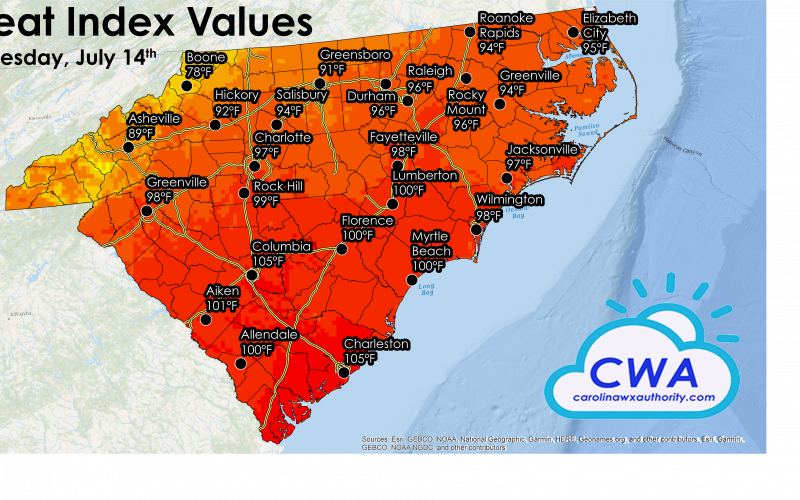
Daily Forecast for Tuesday: Heat Index Values
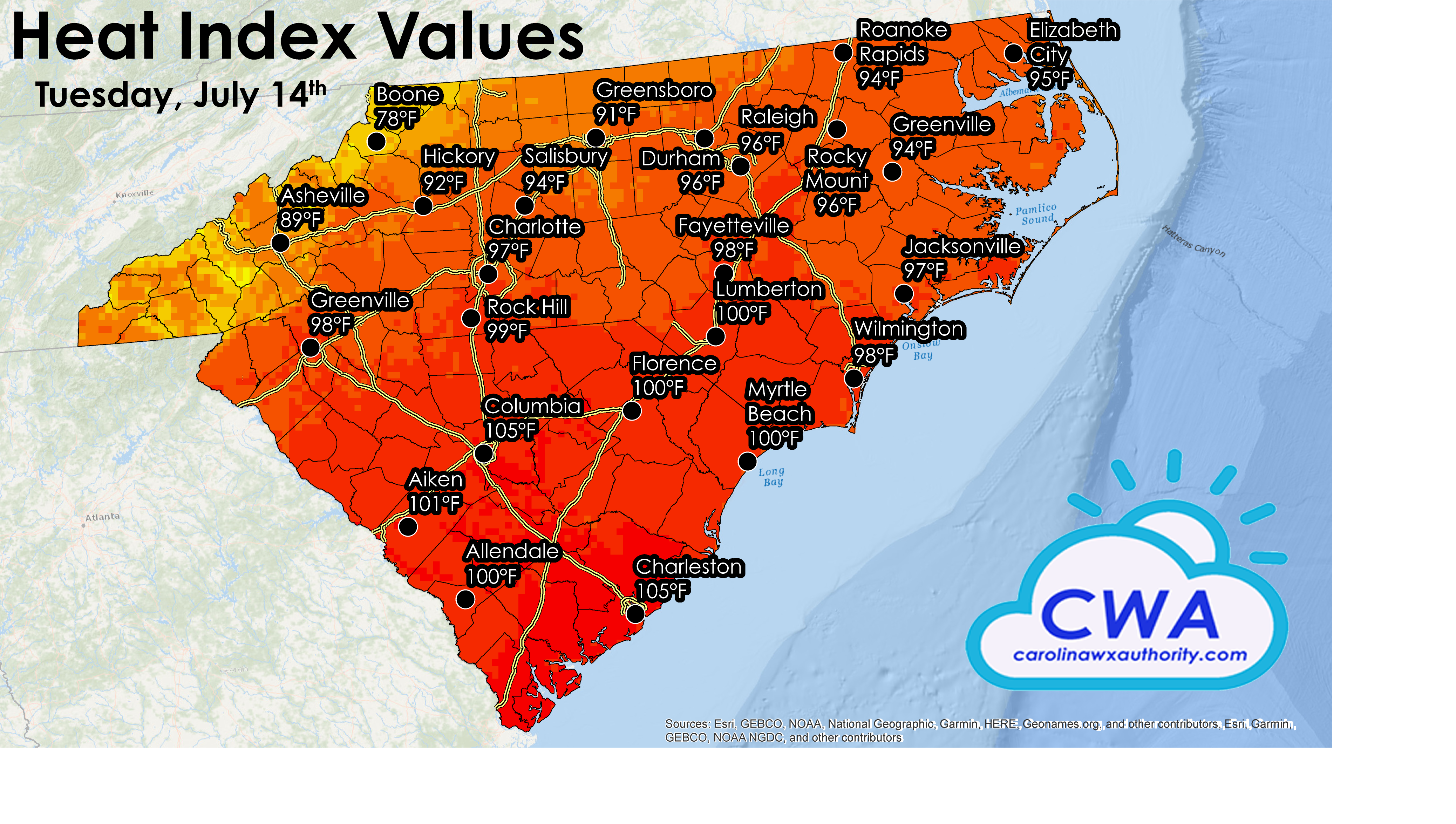
If you think this looks bad, you need to read up on what is coming next week! As for the daily forecast for Tuesday, the most impacted places for excessive heat indices will be in southeastern South Carolina. Rock Hill, Columbia, Aiken, and all points east will likely hit a heat index of 100+°F! For most locations, maximum humidity should stay below 75%. Sadly, that is going to change going into the end of the work week.
Be sure to stay up to date with the latest updated by following our Facebook Page and checking out our freely available selection of various models and radar outputs on the Model Page!
Stay safe, stay hydrated, and have a great Tuesday!
-CWA
You must be logged in to post a comment.