
A Tale of Two Carolinas
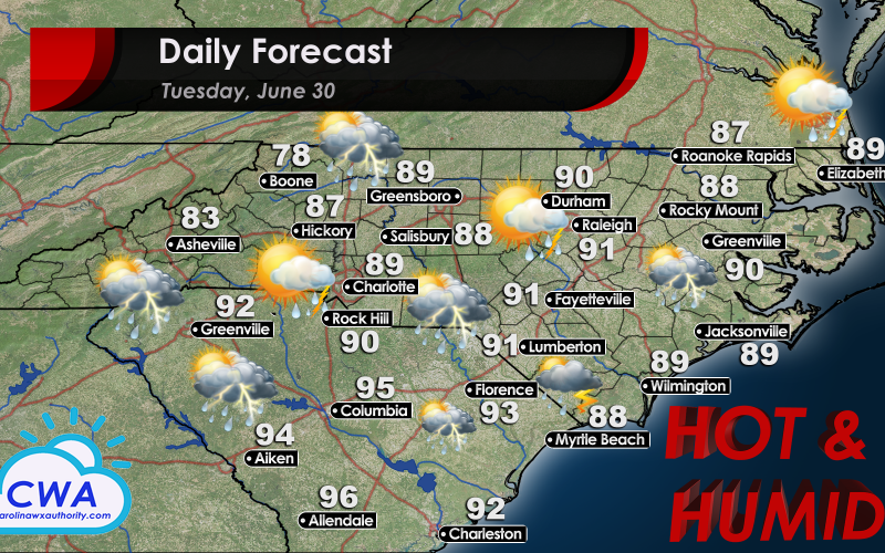
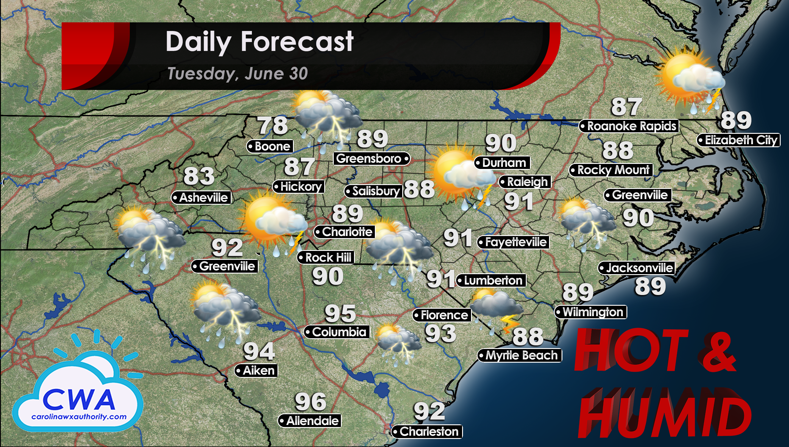
There are basically two types of weather happening tomorrow. Let’s start the daily forecast in South Carolina. The Storm Prediction Center has placed the entire State of South Carolina under a marginal risk for severe thunderstorm activity tomorrow. However, this is essentially the summer pattern we are all used to; daytime heating leads to thunderstorm development. I am expecting the storms will be most intense from Myrtle Beach to Columbia, and all points south of there. The heat index in these locations will be well over 100°F by 2pm or 3pm. All that moisture can really help supercharge convective storm activity.
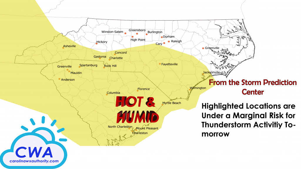
As for North Carolina’s daily forecast, we can expect that all too familiar summer pattern of pop-up thunderstorms. Much of the state is also under a marginal risk for severe thunderstorm development, including most of the southern half. Humidity will not be as much of an issue as it will be to the south. However, be prepared for heat index values in the mid to upper 90s.
Remember to stay hydrated out there when doing any kind of outdoor activity! Stay safe, and be sure to check out Meteorologist Joshua Nagelberg’s article for the Fourth of July weather outlook!
You must be logged in to post a comment.