
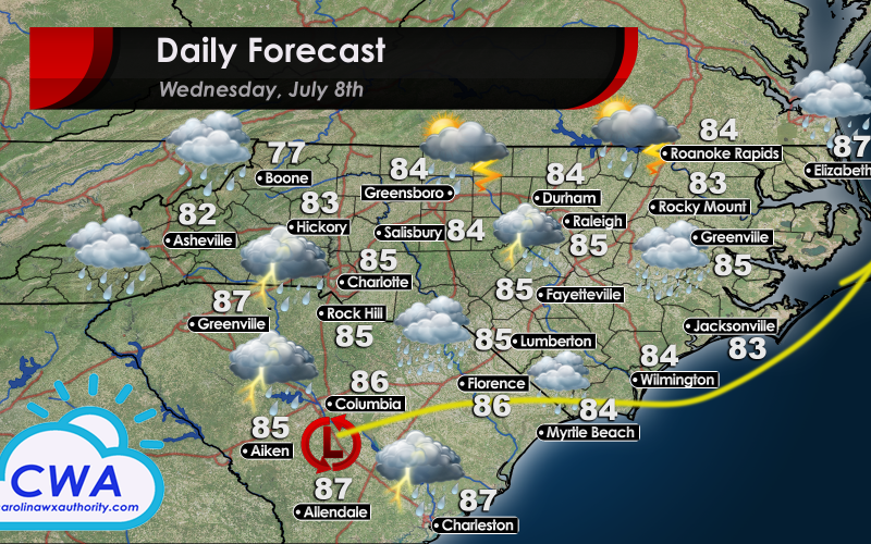
Potent Rainmaker Moves Through the Region Wednesday
North and South Carolina can expect a continuation of the weather conditions we saw on Tuesday. A potent, though disorganized, low pressure system will make its way through South Carolina Wednesday. This system will likely skirt the NC/SC border before moving out to sea Wednesday evening. This system is then expected to make a northward turn. These turns can slow the system’s forward motion, and if it makes it out to sea before turning, there is a good chance that it will begin to feed off the warm coastal waters. This scenario would generate the most rain for Wednesday/Thursday across the Carolinas. However, even if the system turns north before moving out to sea, it will continue to draw moist air off the Atlantic. Regardless of the track, expect drenching rains over the next 48 hours. Flash flooding is definitely a concern, especially in low-elevation areas, as well as those areas near rivers/streams. Stay tuned to Carolina Weather Authority during the day Wednesday for the latest updates!
You must be logged in to post a comment.