
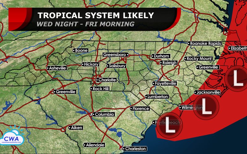
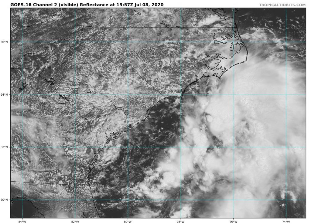
We’ve been tracking low pressure which formed over the northern Gulf of Mexico late Sunday as it moved northeast into Georgia and South Carolina over the last 24 hours. Now the low is moving off the coast near Myrtle Beach. The National Hurricane Center is giving the low a 70 percent chance of becoming a tropical or subtropical depression or storm by Saturday. The water off the coast is warm enough to support gradual development, but currently thunderstorms remain disorganized and displaced to the east of the center, mostly over coastal waters. As the evening wears on and land cools, a circulation could try to form and fire new thunderstorms off the coast of Cape Fear. This area could develop into a tropical system as soon as tonight if that occurs. Winds to tropical storm force (39 mph or more) will be mostly confined to offshore waters, but could impact the Outer Banks.
The system will turn up the coast and may move over the Outer Banks or Albemarle/Pamlico Sounds on Thursday and Thursday night. This could slow development some. By Friday morning, most of the circulation looks to be pulling away to the north-northeast and will parallel the Virginia and Maryland coasts where it may have its best chance at becoming a tropical storm, with maximum sustained winds likely in the 40-50 mph range. The next name on the list is Fay, and Fay would be the earliest sixth named storm on modern record. Up until this year, no more than 5 named storms had formed before July 11th as we remain ahead of the pace of the record 2005 Atlantic hurricane season!
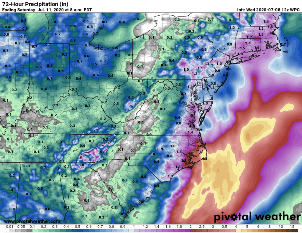
Regardless of development or not, very heavy rain will continue to impact far eastern North Carolina, mostly the Outer Banks. Rainfall amounts appear to exceed one inch in most coastal counties from North Carolina to Maine over the next 72 hours (3 days). It appears that while locally heavy thunderstorms could impact areas west of I-95 and U.S. 1, steady rain should avoid the Triangle, Fayetteville, and Richmond as the bulk of the moisture remains confined to coastal waters. Conditions at the beaches look to stay rough through Friday morning, with gradual improvement from south to north in time for the weekend. However, additional showers and storms will accompany a cold front Saturday with locally strong thunderstorms possible across the entire region.
You must be logged in to post a comment.