
It seems we are in an active severe weather pattern in the past few weeks or so, and there’s no sign of it letting up anytime soon. This can be unsettling for some, especially at night. But this time, it looks as if the storms will come through during the daytime AND early night hours so many of us will be awake. However, the catch 22 with this is that the sun will be out which will fuel the storms to reach severe status, the ones that do actually form before sunset.
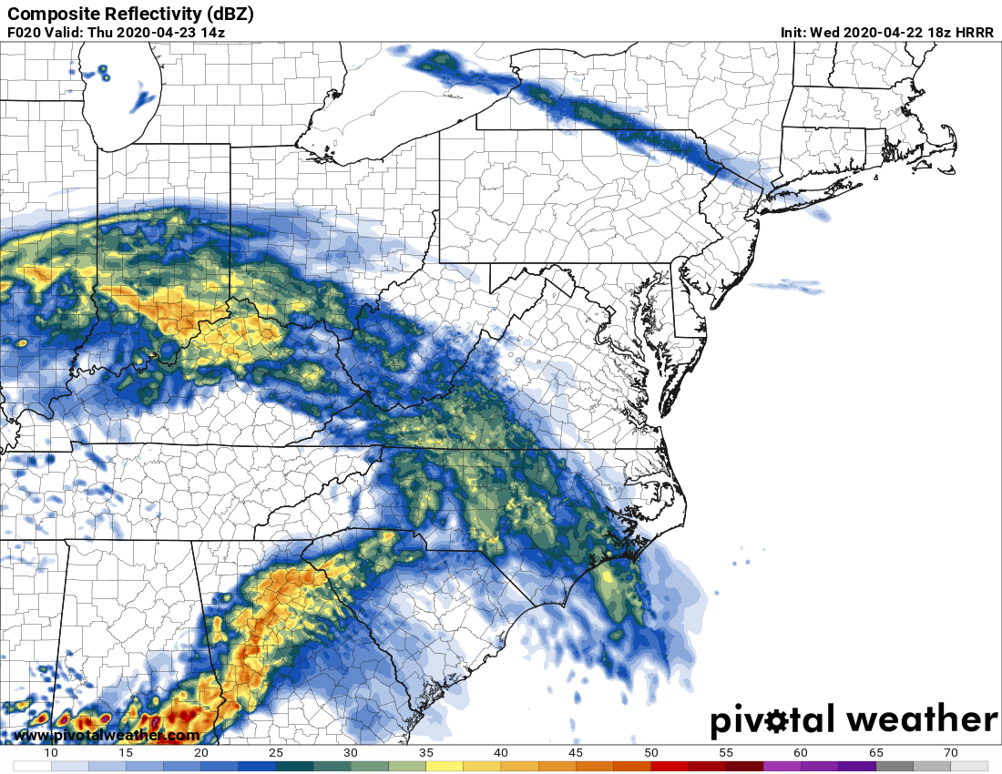
Around 10 am or so on Thursday, a large rain shield will overspread much of NC. There is not expected to be much severe activity embedded in this rain. This is the futurecast radar for around then.
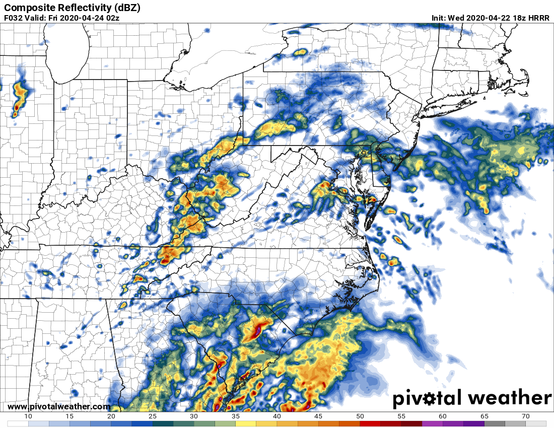
However as the day progresses, and especially later in the day is when we see are severe chances start to climb. The futurecast radar shows nasty storms down in SC around 10 pm Thursday night, however the activity may get started before then. SC does look to be hard hit from these storms which could contain damaging winds and tornadoes.
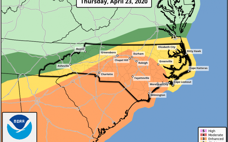
The Storm Prediction Center has placed much of NC and almost all of SC in an Enhanced Risk, which means that anyone in the orange area have an increased risk of seeing severe weather Thursday, including possible tornadoes.

Have a plan of action for your safety, and also have a way to receive NWS warnings even if the power goes out!
Please share this informative article with your family and friends using the FB share buttons.
You must be logged in to post a comment.