
It will be windy today and tonight for the Carolinas and surrounding states, and then rain will spread from west to east after dark. We are watching what could be a rather intense squall line that moves through around midnight for the Charlotte area, however not too many tornadoes are expected this time, just some wind damage in spots.
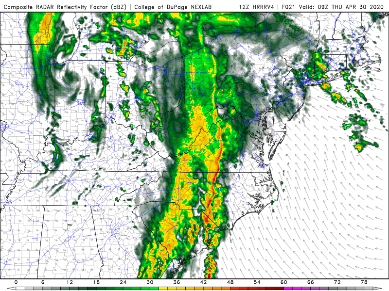
The futurecast radar for midnight below shows the squall line just to the west of Charlotte. There could be some intense storms from South Carolina down into Georgia.

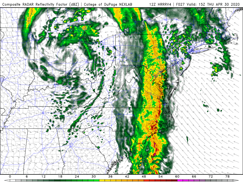
This line will push east into the Raleigh area and northeastern SC around 5 am (below). There still could be damaging wind gusts within this line.
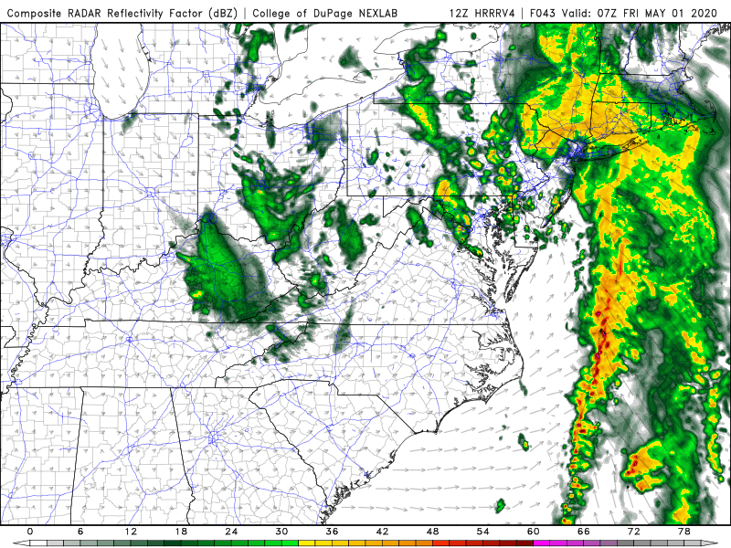
Rain and storms may linger in eastern parts of NC and VA into 11 am on Thursday shown below. Rain could be heavy at times causing flash flooding.
By Thursday night (below), things seem to clear out and we dry up. Then it will start to warmup this weekend, especially Sunday!
Stay safe tonight and expect power outages if the wind picks up in the approaching squall line. Charge your phones before you go to bed.
-CWA
You must be logged in to post a comment.