
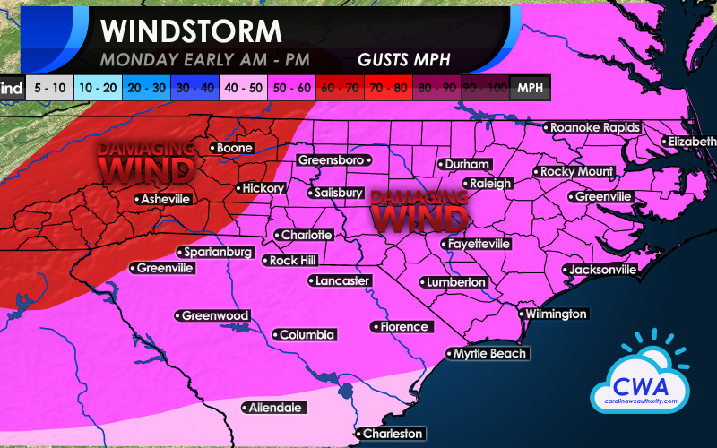
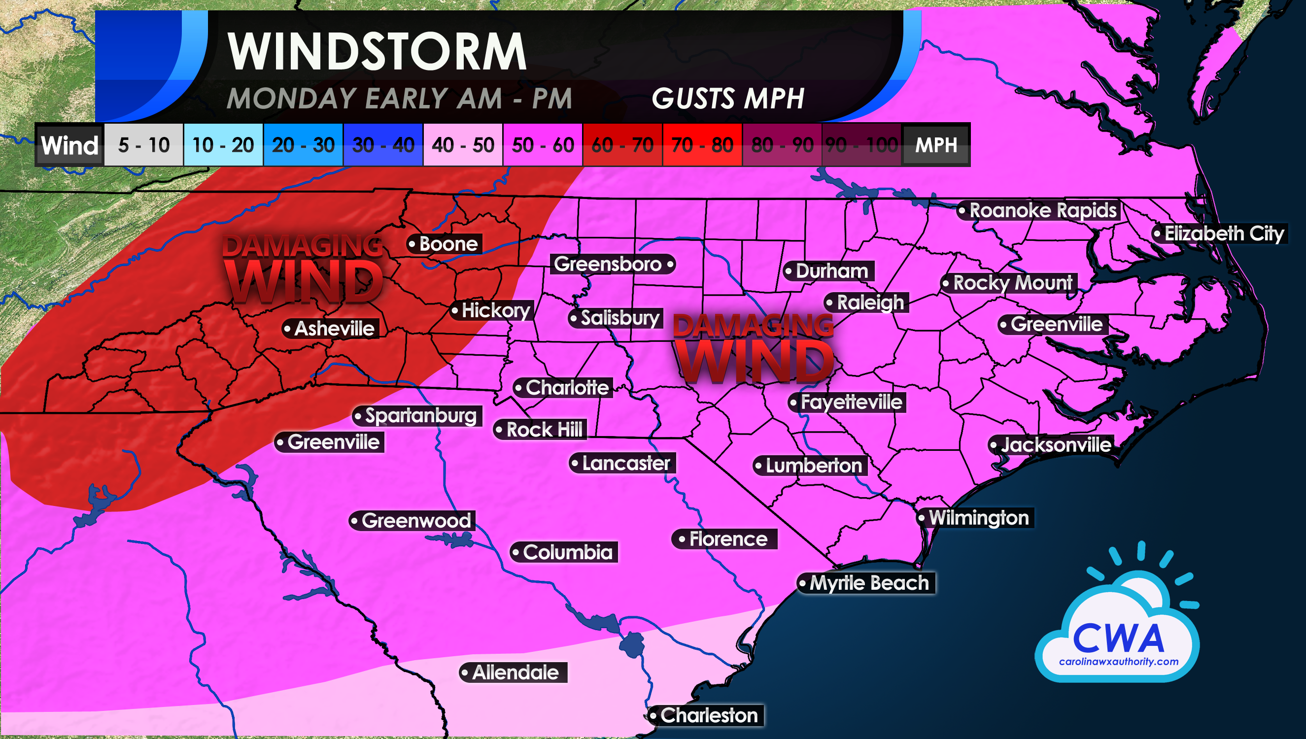
As a powerful cold front will push late Sunday night, it will bring with it damaging thunderstorms and tornadoes for the Southeast. However, the threat is not over even after the storms pass and the front moves through. Behind the front, very windy conditions will prevail, and some may see gusts up to 60 mph which will bring down trees and powerlines across the Carolinas. Expect it to be a rough night Sunday night, with howling winds, especially after the front moves through. Plan for power outages for possibly an extended period of time.
Since the ground is wet, it will be easier for trees to topple. Try to not park your car under a large tree. Also, secure loose outdoor furniture and patio umbrellas, or any objects that might be toppled or blown away.
Below are approximate wind gusts that you can expect for your area. The highest winds are expected in the foothills and mountains. Still, very windy conditions are expected all the way to the coast, with the exception of the Lowcountry, where 40 mph gusts are more likely.
Tractor trailers need to be mindful of these expected windy conditions, since they are high-profile vehicles. Again, the time frame is late Sunday night into the early morning hours on Monday.
Make sure to have your phones fully charged, since Monday morning may come and you will miss any alarms to wake up.
You must be logged in to post a comment.