
NOT A TREAT BUT RATHER A TRICK
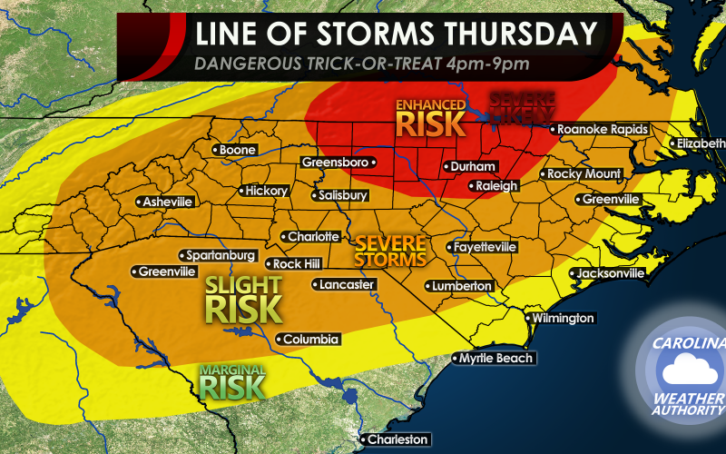
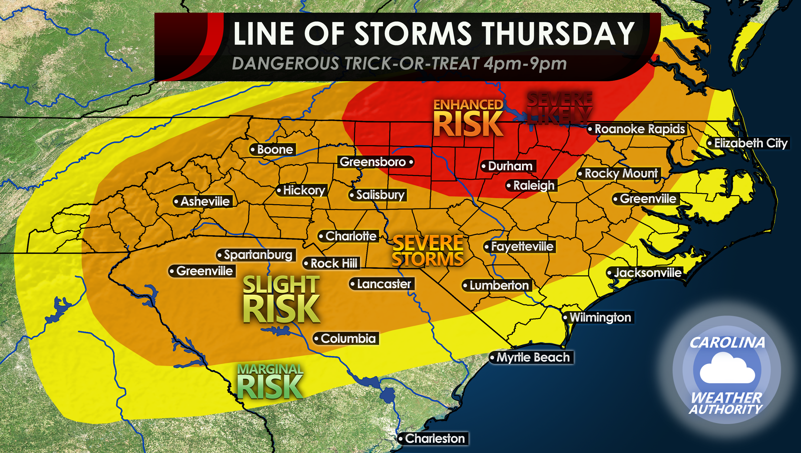
The SPC has upped the ante today in regards to a potent line of storms due to move across our region Thursday afternoon and evening. This line of storms will usher in colder air behind it, and it will be windy. The drop in humidity will come at a price, as severe storms are expected to accompany the front as it arrives between 4-9pm across the state. Trick or treating is not advised until the “all clear” has been given. The storms are expected to hit right at prime trick-or-treat hours.
Thursday will be warm and muggy with off and on rain in spots, and breezy for most of the day. But then the powerful cold front comes roaring in.
Charlotte and much of NC will be under a slight risk to see severe storms and tornadoes are not ruled out. This risk extends down into SC. Power outages possible.
The Enhanced Risk will include Raleigh and Greensboro, and up into Virginia. This is the most likely area to see severe storms and tornadoes. Power outages likely.
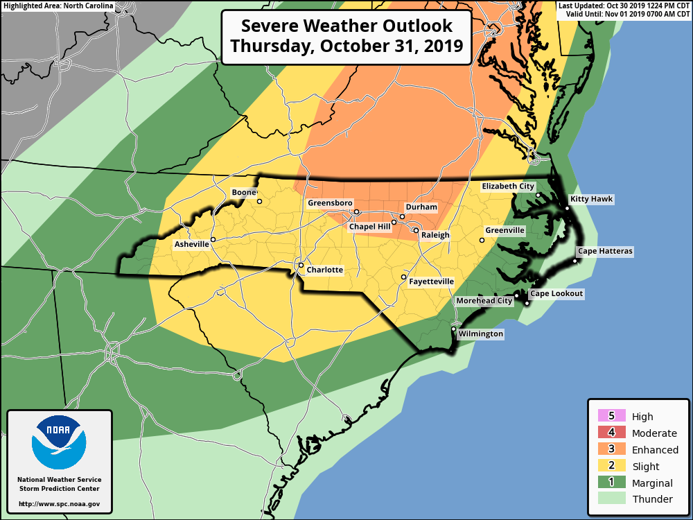
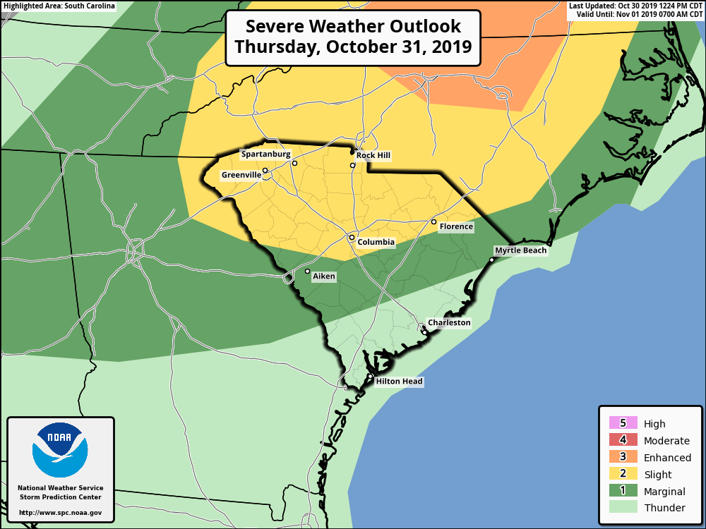
Below are the OFFICIAL SPC outlooks for both North and South Carolina. This information may change over the next 24 hours, so please consult your local NWS office or the SPC for official forecast and safety information https://spc.noaa.gov
Stay safe tomorrow and enjoy the holiday if you can do so safely! Outdoor events are strongly discouraged anywhere there is a color outline below!
-CWA
You must be logged in to post a comment.