
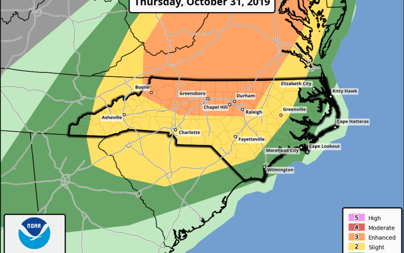
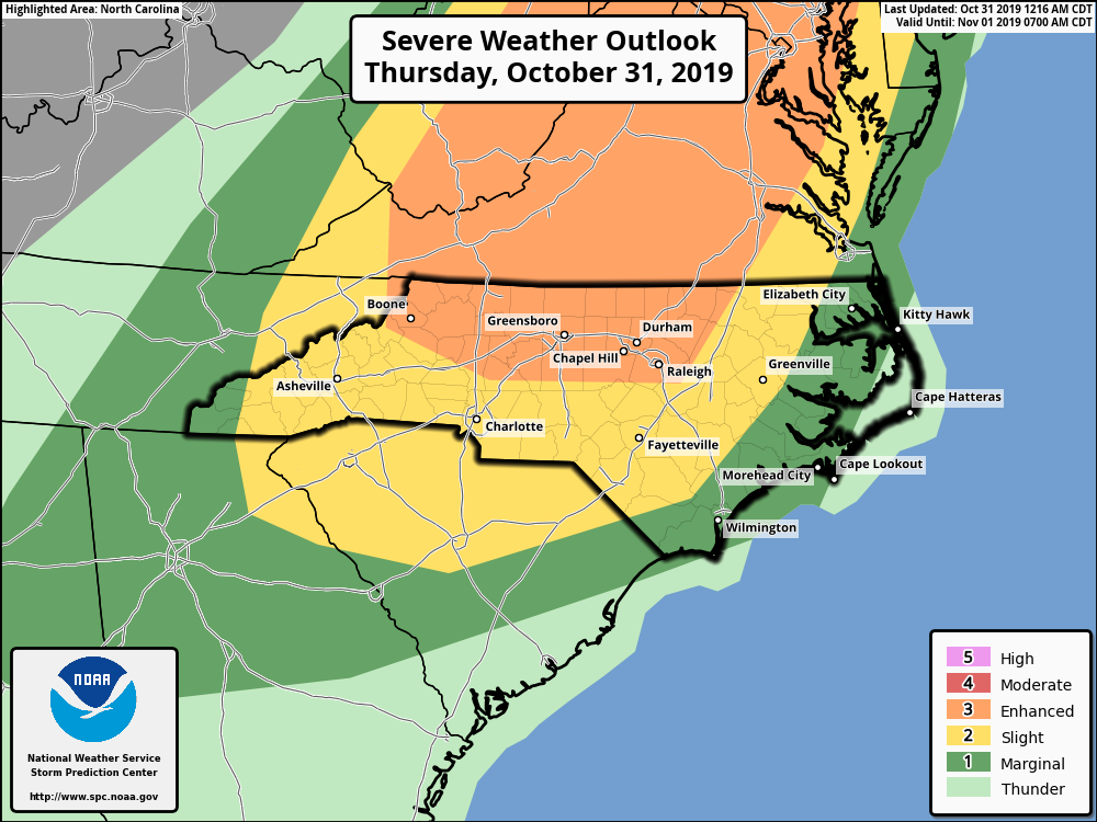
The SPC has extended the coverage area today for an enhanced risk of severe weather to the west. The squall line is still set to move across our region between 4pm and 9pm today. Trick or treat activities may have to be rescheduled for Friday when the weather will cooperate much better, although it will be chilly. Anywhere in the yellow or dark green could also see severe, so it’s not just limited to the orange area. Today will be warm and humid and a bit breezy with drizzle or rain in spots. Then later today the squall line approaches from the west and the worst weather will occur from west to east. Pay attention to radar today and your local news media. Damaging wind gusts, torrential rains, and even a tornado are all possible today. Travel is discouraged during this window.
-CWA
You must be logged in to post a comment.