
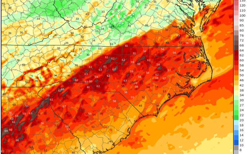
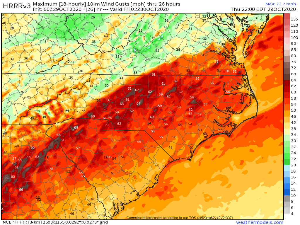
As Hurricane Zeta has made landfall over New Orleans tonight, the storm will race northeastward. Thursday morning across the western Carolinas could be rough, as we can expect wind gusts near 60 mph. This will cause widespread power outages as well as downed trees and power lines. Below are the HRRR model forecast wind gusts for Thursday morning into early Thursday afternoon.
It will not be a good day to be on the roads, as they will likely be littered with tree branches and leaves. Heavy rain combined with wet leaves will make for treacherous travel. High wind gusts will take down trees due to the damp soil.
If you can, Thursday will be a good day to stay home and off the roads. The worst should be over by the evening hours. However, things could remain breezy into the evening hours. Friday conditions will improve and it should be a better day.
Stay safe!
You must be logged in to post a comment.