
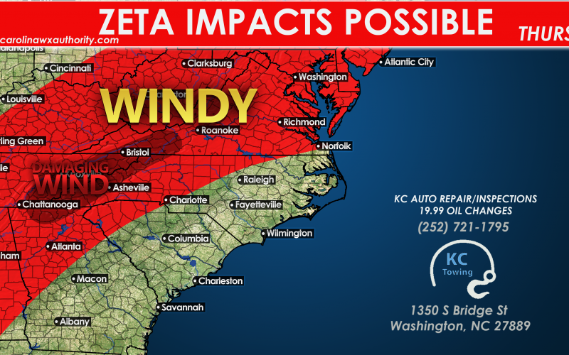
Another Gulf Storm is approaching, and it seems to be a common theme this year. However this storm will be fast-moving, and when a landfalling tropical system moves fast as it moves inland, the effects last longer over distance. Since this storm will be fast-moving, it means that the winds will not weaken quickly as it approaches the Carolinas and Southeast. Winds will cause widespread power outages and will cause many downed trees and power lines Also, the risk for severe thunderstorms including tornadoes also exists. This all happens during the day on Thursday, so be sure to remain weather aware.

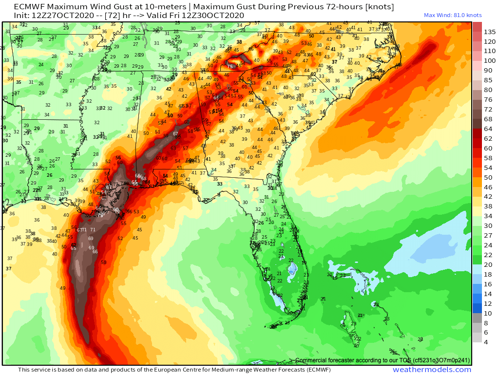
Below is a look at some of the Euro model forecast maximum winds gusts for Thursday. The worst swath of winds will be along the spine of the Appalachians, as winds could gust as high as 50 mph. These areas will likely be the hardest hit.
The timing again is during the day on Thursday. Watch for power outages, high winds, and many tree branches down in the streets and roads. Also there is a risk of tornadoes, so have a source for NWS warnings on Thursday.
You must be logged in to post a comment.