
As the latest pattern has trended on the warm side, and will continue to do so, changes are expected at the end of the month. As we begin this week, things will quickly warm up once again, and the humidity will remain high. As a tropical disturbance moves onshore in the central Gulf Coast, moisture will spread our way, and the western Carolinas will once again be in a swath of heavy rain.
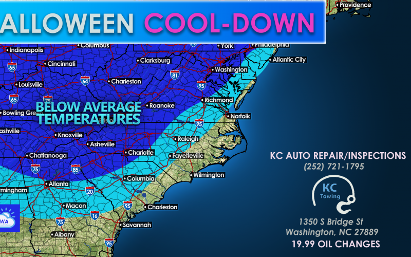
As this system moves offshore to our east on Thursday and Friday, drier and cooler air will wrap in behind. The chilly air will not settle in until Saturday morning, which is Halloween. The chilliest temperatures are expected in western regions, while cool air will spill as far east as the Coastal Plain. At the beaches, there will be a noticeable chill in the air, but nothing unusual for this time of year.
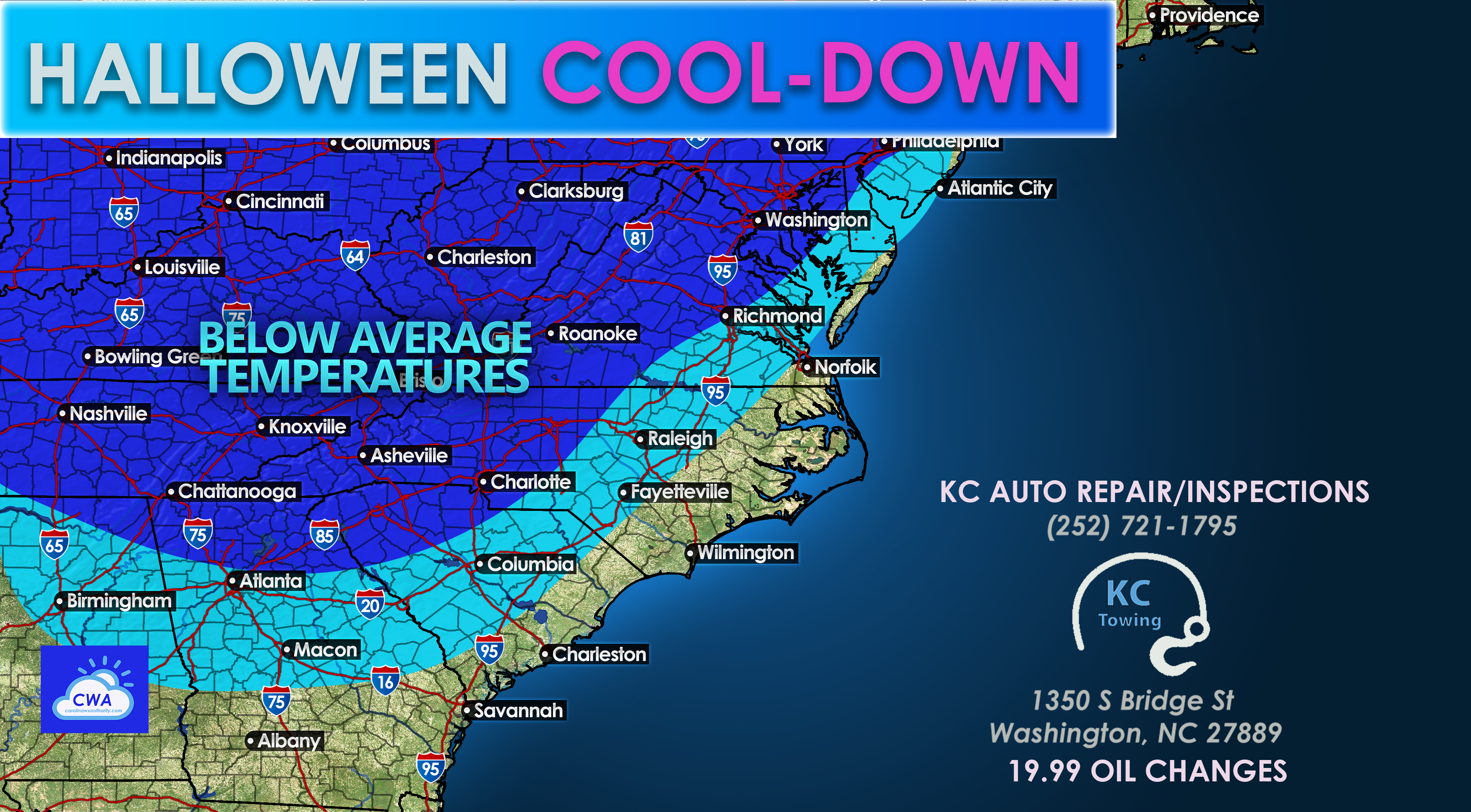
Unfortunately the chill does not look to stick around long, as temperatures are expected to rebound quickly into the 1st and 2nd of November Temperatures will become seasonal normals and then will begin to rise once again, and will become above normal.

While we will enjoy a chilly Halloween weekend, temperatures after begin to climb once again as the cold outbreak will be short-lived.
Stay with us here for all the latest! We ask that you please share using the button below and also on Facebook with your friends and family!
You must be logged in to post a comment.