
DORIAN A POWERFUL HURRICANE
Many of us are on pins and needles this Holiday Weekend, anxiously watching where Dorian will go. The storm is currently a monster hurricane, and will likely achieve Category 5 status Saturday night. This does NOT mean he will bring Category 5 conditions to the Southeast. It just means he is a very powerful and dangerous hurricane, and needs to be monitored.
In fact, follow along with us on our models page which is automatically updated here ~~~> https://carolinawxauthority.com/models
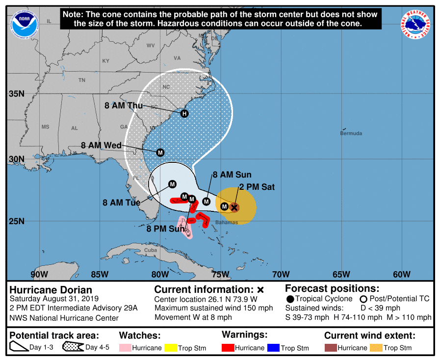
The cone of uncertainty from the NHC suggests a wide range of track possibilities with Dorian. He could just skirt the coast, stay offshore, or move inland and some point over the Carolinas. We will have to see exactly where as things become more clear in the coming days.
Current NHC forecast and cone:
Follow along with the NHC here: nhc.noaa.gov
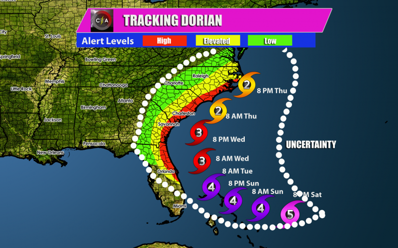
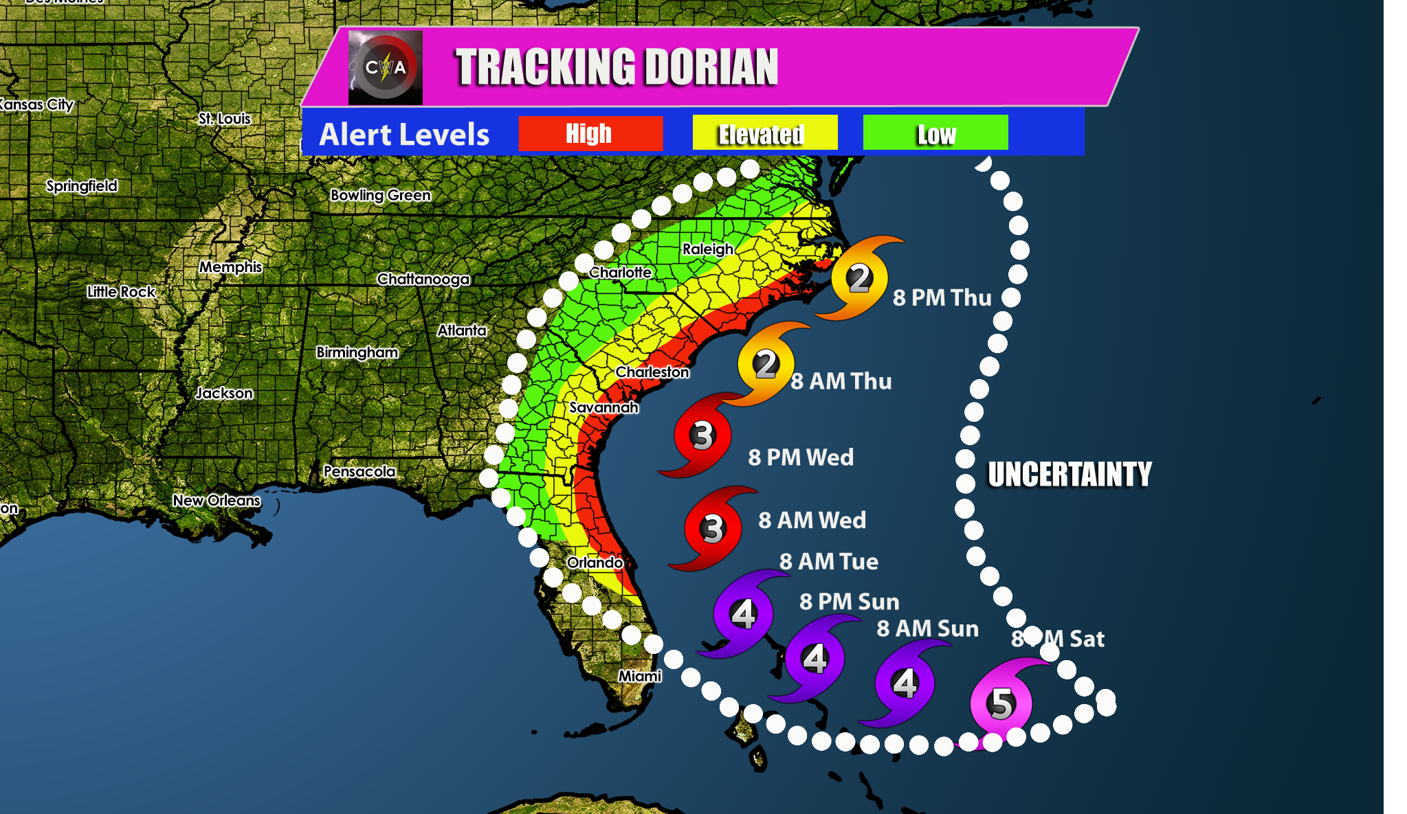
Dorian is expected to slow down in forward speed as he approaches the Southeast coastline. The longer he stays over water the longer he will stay a major hurricane, at least a Cat 3.
In the red, make preparations to evacuate if told to do so by local authorities. Remain calm while doing so.
Our current thinking is in the graphic below, and coincides with the NHC official forecast, with perhaps only slight deviations. This is to be taken seriously. For now, just monitor and be prepared to take action if necessary!
Please share this article with family and friends using the sharing buttons below.
-CWA
You must be logged in to post a comment.