
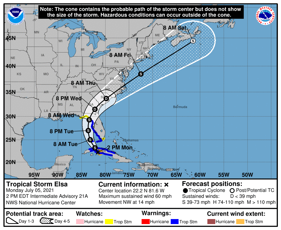
We hope everyone had a safe and Happy Fourth, and Observed Holiday today! Elsa is currently a strong tropical storm over Cuba this Monday evening. She is not expected to strengthen much further, and could remain a strong tropical storm until she makes landfall into Florida. Her current forecast path issued by the NHC takes her into Florida on Wednesday and then into the Carolinas this week, but she will weaken before reaching us. Elsa is only expected to be at tropical depression strength when she reaches us, which is weaker than a tropical storm.
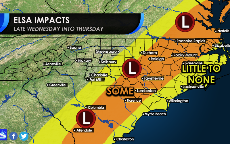
However, folks should not let their guard completely down, as tornadoes and flash flooding are some threats from a landfalling tropical system. We have outlined the expected impacts in the map below. Little to no impacts are expected in the yellow for west-central NC and the eastern half of SC, but there could be flash flooding, tornadoes, and scattered power outages in the orange. The right side of a tropical system is usually the most threatening, hence our outline.
Majority of the 12z EPS members for #Elsa show a track into the FL Big Bend area and then up the Ga/Carolinas eastern piedmont/coastal plain. Some intensification in the eastern Gulf shows as well. pic.twitter.com/lG2sBw7gK2
— Allan Huffman (@RaleighWx) July 5, 2021
These impacts are not expected to be widespread, but rather scattered in the orange. Winds will guts from 20-30 mph with perhaps some 40 mph gusts, which could last around 2 hours.
Be aware these could be some of the impacts in the orange, and even the yellow. Again, not expecting a widespread damaging event, but some folks will experience more impacts than others. Remain weather aware, and make sure to have all electronic devices fully charged on Wednesday.
We will update, so please check back!
You must be logged in to post a comment.