
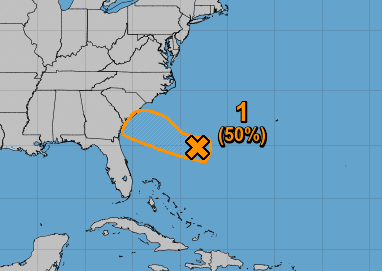
There is currently an area of disturbed weather off our coast, and it will continue to spin and head towards us. What will or what does this mean for us. More than likely and increased risk of showers and thunderstorms especially for SC and GA. But the rain and overall moisture will spread into NC as well this week.
It will be a super humid week along with typical summertime heat. And it won’t be a great day at the beach tomorrow for the SC beaches. There could be a stiff breeze but nothing major as far as winds. The more impactful part of this system will be rain and storms.
Currently, the NHC has this area of interested pegged at 50% for development. This could become a tropical depression at the most. This means sustained winds less than 35 mph.
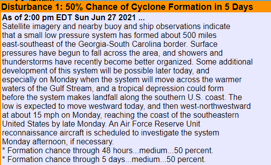
Official NHC discussion:
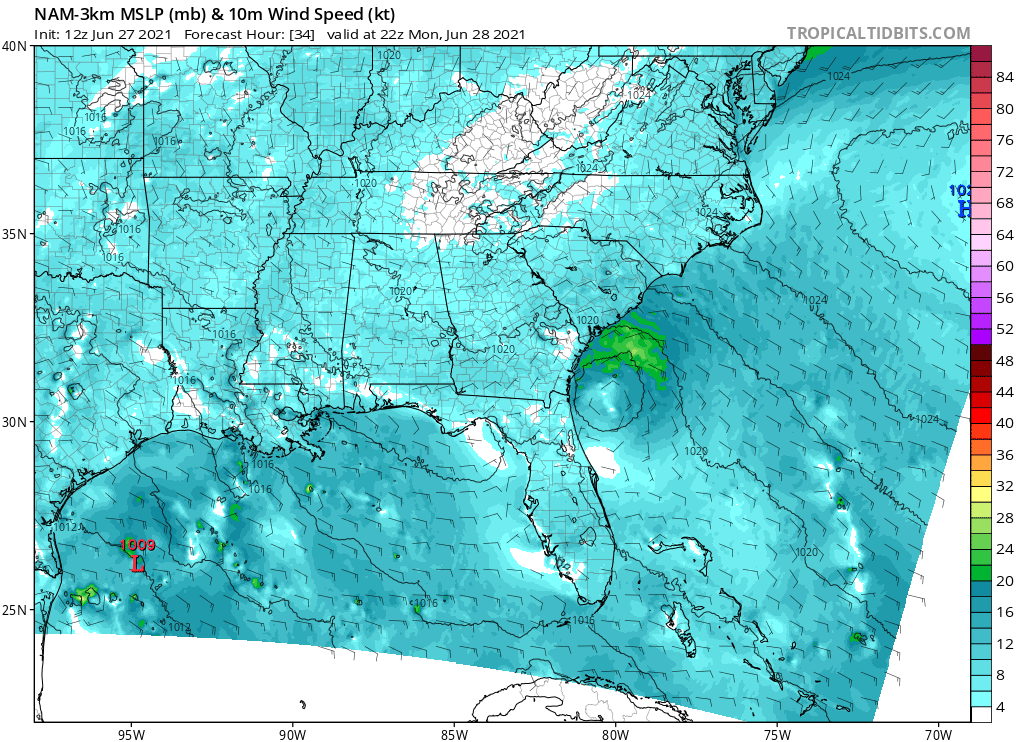
The high-resolution NAM model forecast below indicates a swirl quickly approaching the SC/GA coastline tomorrow. The enclosed area with a bit of green above it is our tropical disturbance. This is NOT expected to be a big deal, or a widespread event. Just a reinforcement of humidity and daily rain chances this week.
Keep an eye on this to see if it becomes a weak tropical storm. But we are not even expecting that. Please share!
You must be logged in to post a comment.