
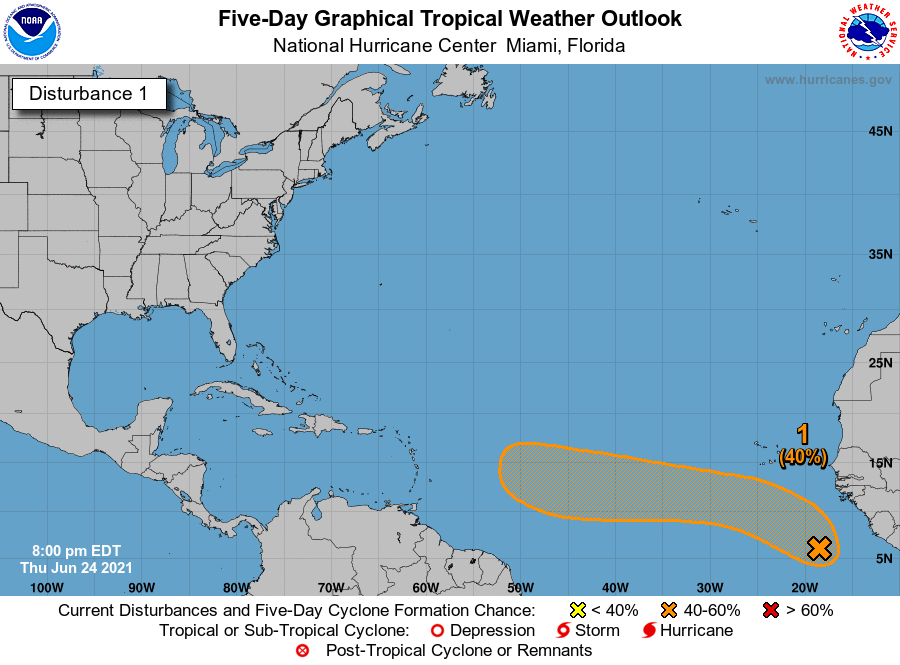
We are still weeks away, but the latest attention has shifted to the eastern Atlantic as models are starting to latch onto what could be our next disturbance. Currently there is a 40% chance of formation by the NHC over the next 5 days. This is a fairly broad area, and this indicates that the chances could be upped in the coming days. Below is the official forecast from the NHC:
Still, it is far too early to know what this thing will do. It could fizzle due to hostile atmospheric conditions. Or it could turn out to sea. Or it might end up only being a weak tropical storm. Or a major hurricane. Everything is on the table currently, however all we can do is watch. That is our biggest strength. No need to stress tonight or in the near future.
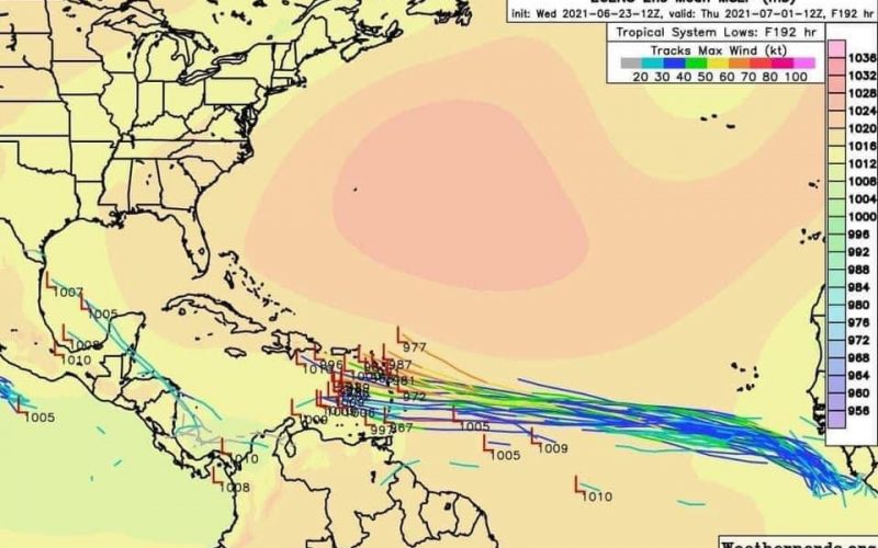
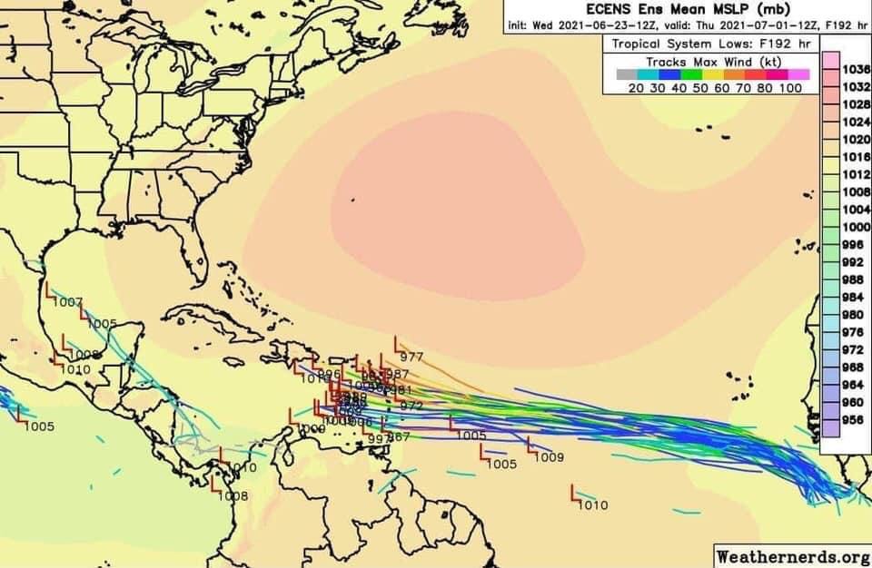
Euro models paint Invest 95L to move towards the Caribbean in the next week or so. This is still a fairly broad model spread at the end of the tracks, which signifies uncertainty as it gets closer. But there is good agreement as this “low rider” moves across the Atlantic.
We are not going to show single doomsday models, as is being shared on FB and Twitter. All this is for now is our area to watch! Of course if things get better or worse, we will be on top of it. This currently does not look like a big deal to us over the next 3 days here in the Carolinas.
It’s simply not known if this thing will stay intact or what path it will take. Since it’s Hurricane Season, residents along the coast should think about alternate plans always.
Please share to raise awareness but not to scare. Thanks.
You must be logged in to post a comment.