
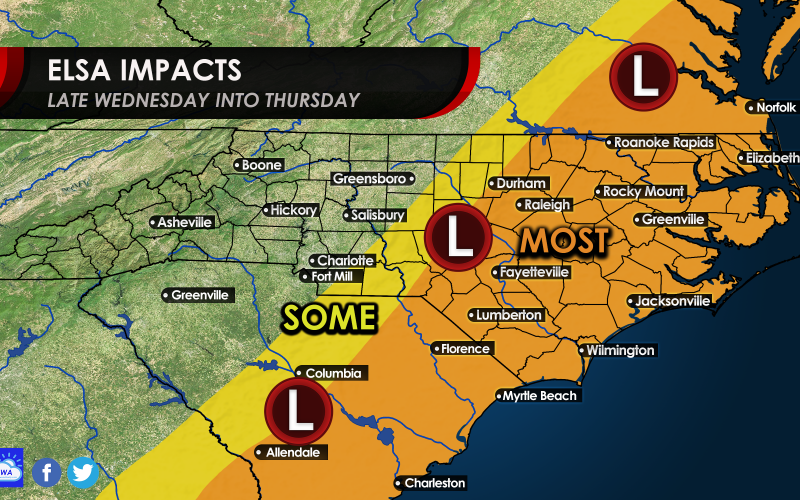
Good Tuesday evening. Tomorrow Elsa will begin to work her way up here as a tropical depression after she makes landfall in Florida late tonight. She will race off to the northeast and track over the Carolinas. In the orange, expect possible tornadoes and winds 30-40 mph. Also expect heavy rain, but this will be a fast-moving system so flooding should be limited overall. The orange area below will see the most impacts from Elsa. Coastal flooding is also a possibility. Elsa could re-strengthen back into a tropical storm as she exits the VA coast. Expect winds to pick up in Southeast VA on Thursday. Wednesday night into early Thursday is the timing for this event.
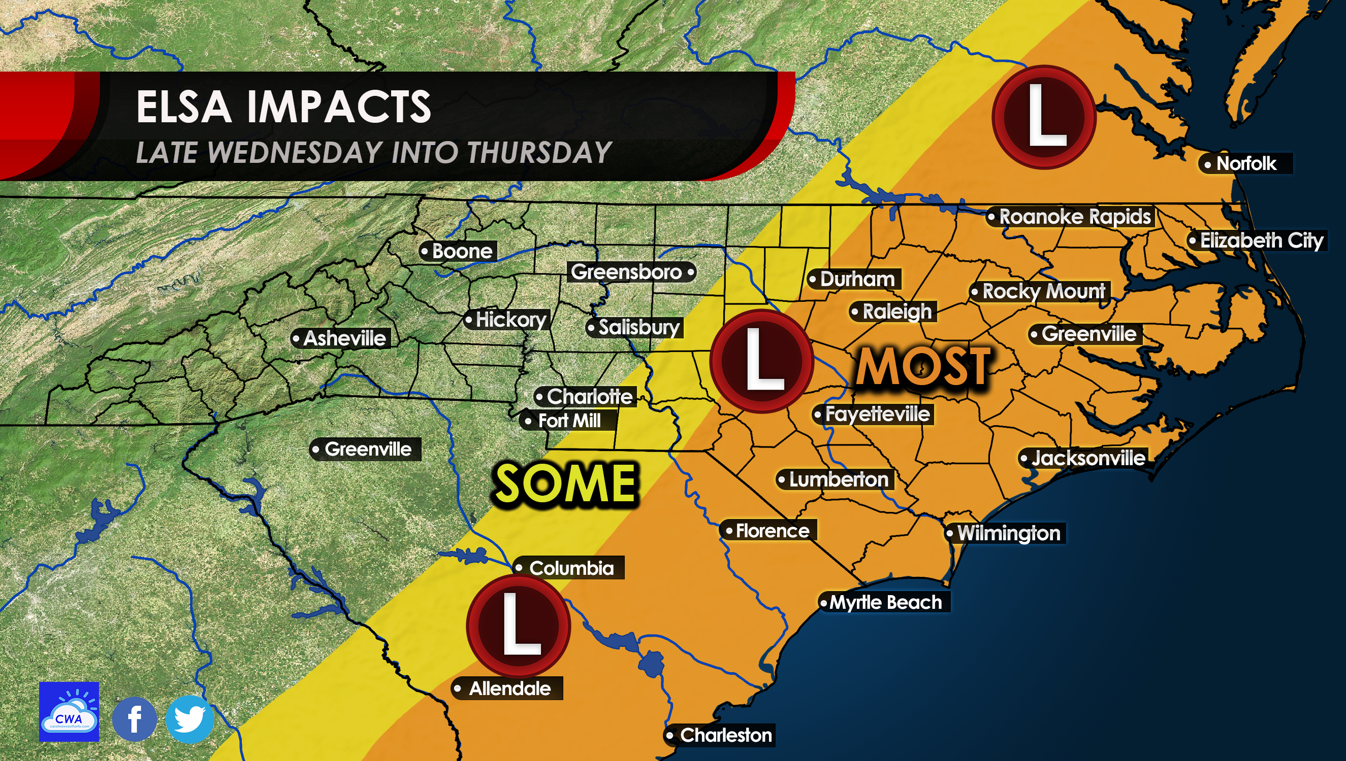
If you or someone you know will be at the beach, hunker down for a day or so, as this should not be too bad. Stay alert for any tornado warnings, and as always, consult your local NWS office for all official information, including life-threatening weather watches and warnings.
We are not expecting this to be a major event, but there could be some power outages with the gusty winds. Stay safe and please share to alert others!
You must be logged in to post a comment.