
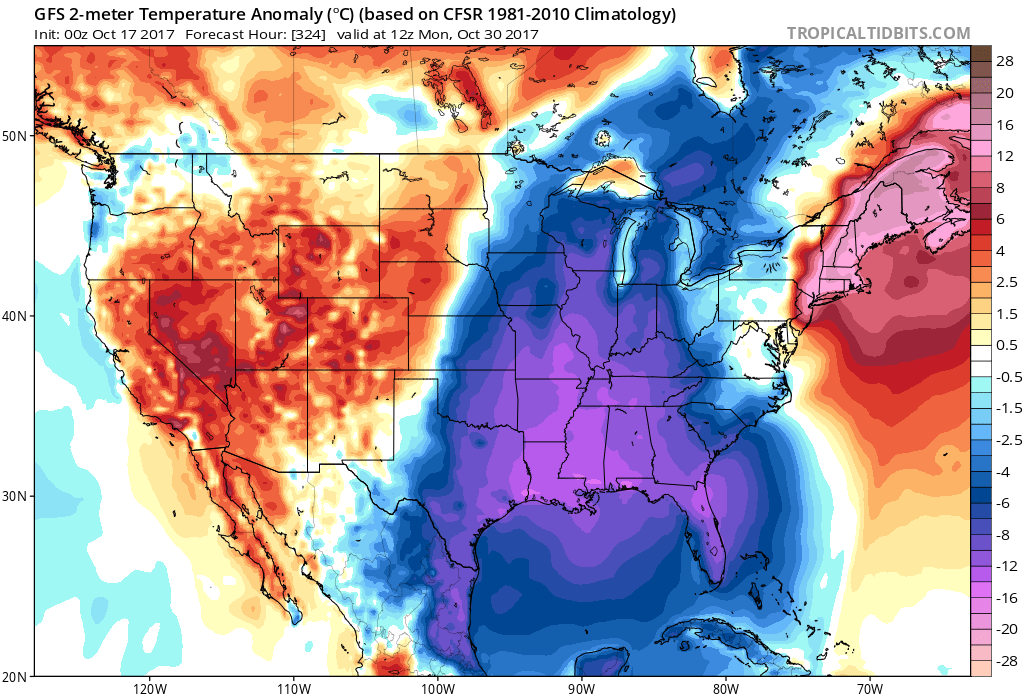
The last few runs of the GFS have been a bit trending towards cold, and that’s not a surprise, since it IS late October when the cold snap will arrive. This cold could come in the form of a coastal low, or an area of low pressure across the South. And yes IF there is enough cold air, the mountains could be enjoying their first white flakes of the season.
A trough of low pressure moves in around the 28-30th, and DIGS in. We will see if this now becomes a trend.
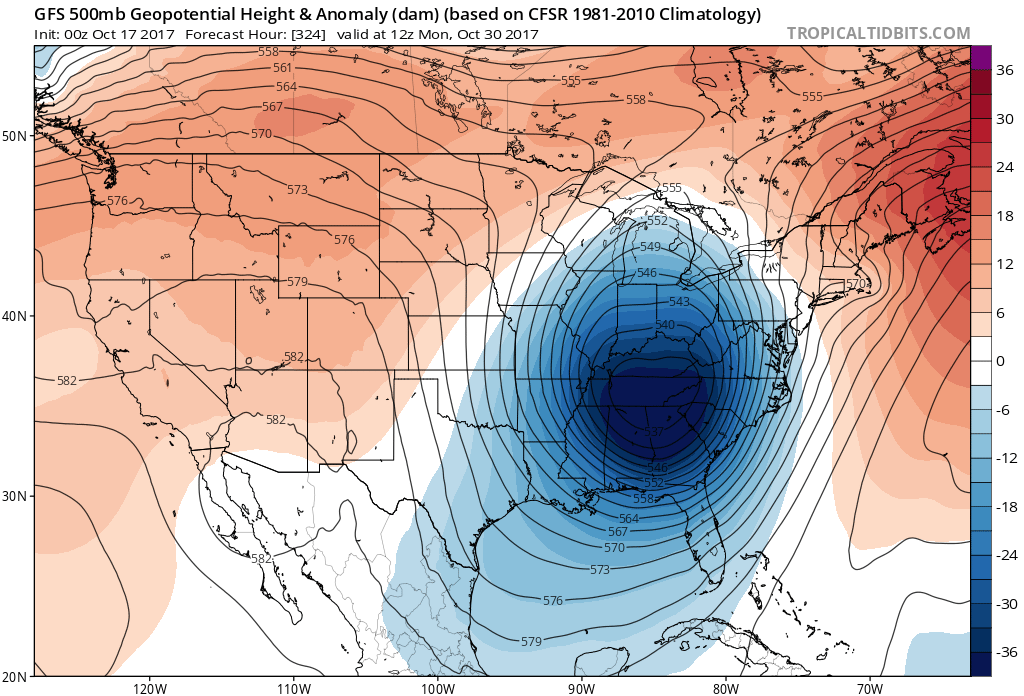
With this deep trough comes BELOW NORMAL temperatures. This tells me that if there is a low, it would be quite strong.
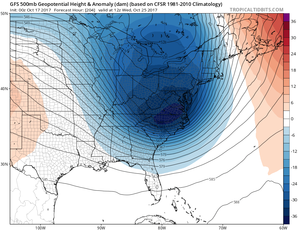
There is still moderate UNcertainty of a strong coastal low hitting around the 30th, 29th, or 28th, however we have another cold snap on the long-range, that could come around the 24/25th.
This would mean a surge of cooler than usual air for this time of year. We could be dropping into the 40s here at night across the South. Elsewhere in the mountains they will be getting some of their first dustings of snow, albeit more by error.
Here we go, seasonal transitions are underway…
-Mike G.
You must be logged in to post a comment.