
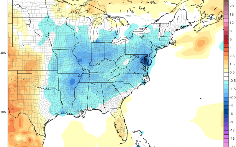
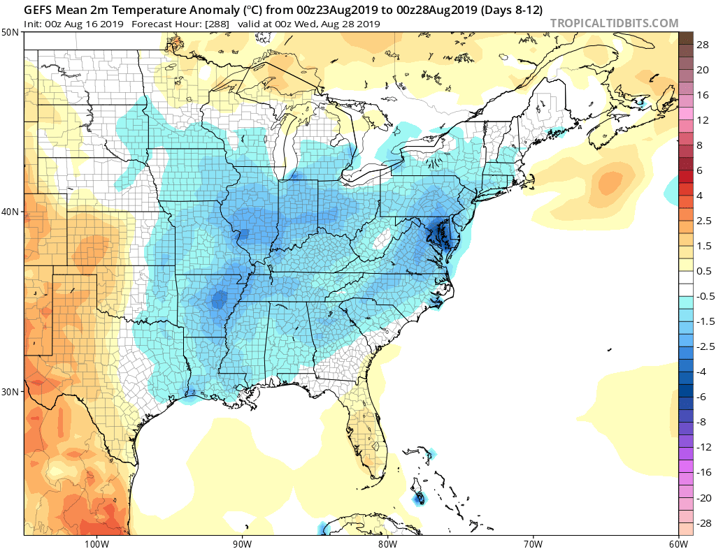
After the recent heat and humidity, changes could be on the way over the next two weeks. This coming weekend will certainly be hot and humid, just like recent days, however, the weekend after is when we can expect a pattern change.
Will the changes be drastic? Will we be in a fall-like air mass? The details are still unknown. But the ensembles are pointing towards an East Coast cooldown.
The one thing we have to watch with a trough pattern over the East Coast is the threat of landfalling tropical systems. However, as of now, there are no threats. Conditions do not look favorable for any tropical systems through the end of this month.
The below-normal temperatures coming in two weeks could be the result of a rainy pattern or an early taste of autumn.
-Mike G.
Meteorologist
Carolina Weather Authority
You must be logged in to post a comment.