
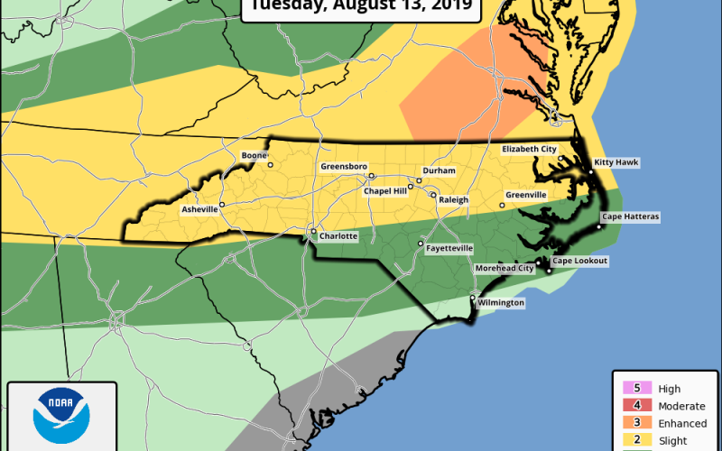
Clusters of heavy thunderstorms will move south from Kentucky and Virginia later today into this evening with an elevated risk of damaging straight-line winds. With a very hot and unstable atmosphere today, conditions will be ripe for these storms to blow up as they make their way into North Carolina. The most likely areas to see severe weather will be the higher elevations eastward into the Piedmont, where a “slight” (level 2 of 5) risk has been issued by the Storm Prediction Center, with a “marginal” (level 1 of 5) yet not zero risk encompassing Upstate South Carolina into Southeast North Carolina.
Watch out for dangerous lightning and heavy rainfall, which may lead to localized flash flooding. Our hail and tornado risk looks isolated, but not zero, with wind damage being our main concern. Be aware that fallen trees and power outages may occur in some areas later today into this evening, especially in Western, Central, and Northeastern North Carolina. Lawn furniture or loose outdoor items may also be blown away or damaged so do be aware of that.
Precise timing has proved slightly difficult to determine as our forecast modeling has been fluctuating on that, but here is a rough estimate from the latest HRRR short range model:

Just be aware this afternoon and evening as storms could move in at any time. Stay tuned for the latest coverage on our Facebook and Twitter pages today as we provide important updates on severe weather discussion, watches, and warnings. Stay safe and have a great day.
-Jesse
Carolina Weather Authority
You must be logged in to post a comment.