
After an average winter of cold and snow for many, although below average snow for the Carolinas as a whole, we are now in a spring preview. The threat of rain will return Friday and into the weekend, but it will not be a washout. In fact, some locations may not see any rain at all while others do. Hit or miss. Could there be a rumble of thunder? Certainly, and do not rule that out.
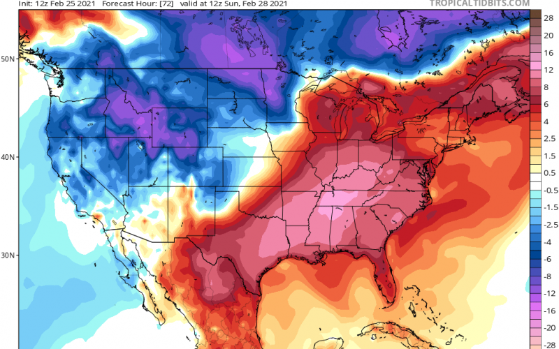
However on Saturday, temperatures look to peak with some locations reaching the upper 70s and even will flirt with 80. Below is the temperature anomalies expected for the last day of February 2021.
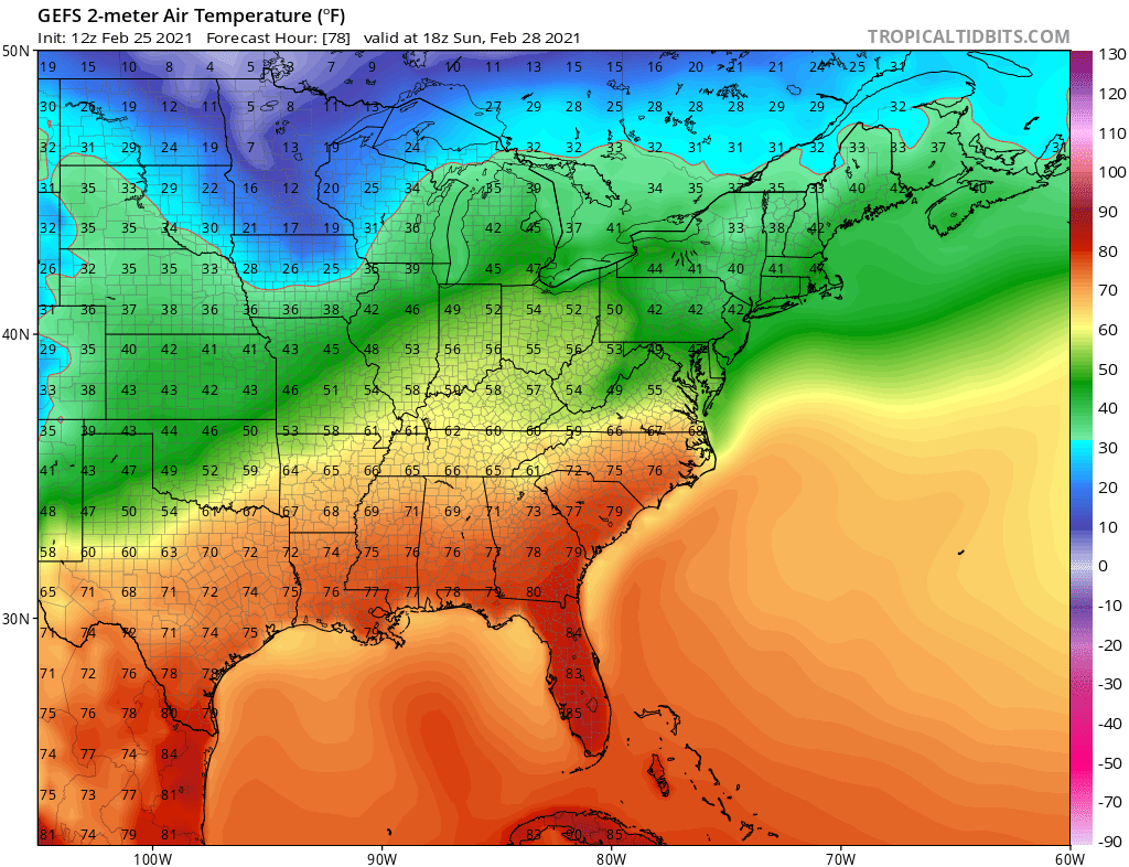
Images below taken from tropicaltidbits.com, click for larger version and be sure to give them a visit!

Below is the overall forecast temperature snapshot for Sunday. Many locations will be in the 70s and there could be a few that read 80 before the day is over. For the Carolinas this will be perfect “road trip” weather so get outside and enjoy it, and get rid of the cooped up feeling! Put the sunroof down if you have one and get outside for a walk or jog (if it’s dry, of course).
On Monday and Tuesday, a cold front rolls in and cools things off, so these temperatures do not look to persist. However, March as a whole could be above average this year. Latest indications also show wetter than average, which is news I can do without.
-Mike, CWA
You must be logged in to post a comment.