
If you want to dream of the white stuff, then what we are interpreting is that somebody, if not most people might see snow flakes on or before the 14th. This is a mean or average taken from the European model and it’s snow output. This is a running total from any storm system that would move through. Mountains are not surprisingly going to get the most over the next 3 weeks, also same for the Lake Effect regions.
Elsewhere, in the dark grey, flurries or even a dusting is possible. Bright blue is where we could see 2-4″ total before the 14th. Purple ranges greatly from 4-12″. Out West and the Lakes will receive greater than a foot.
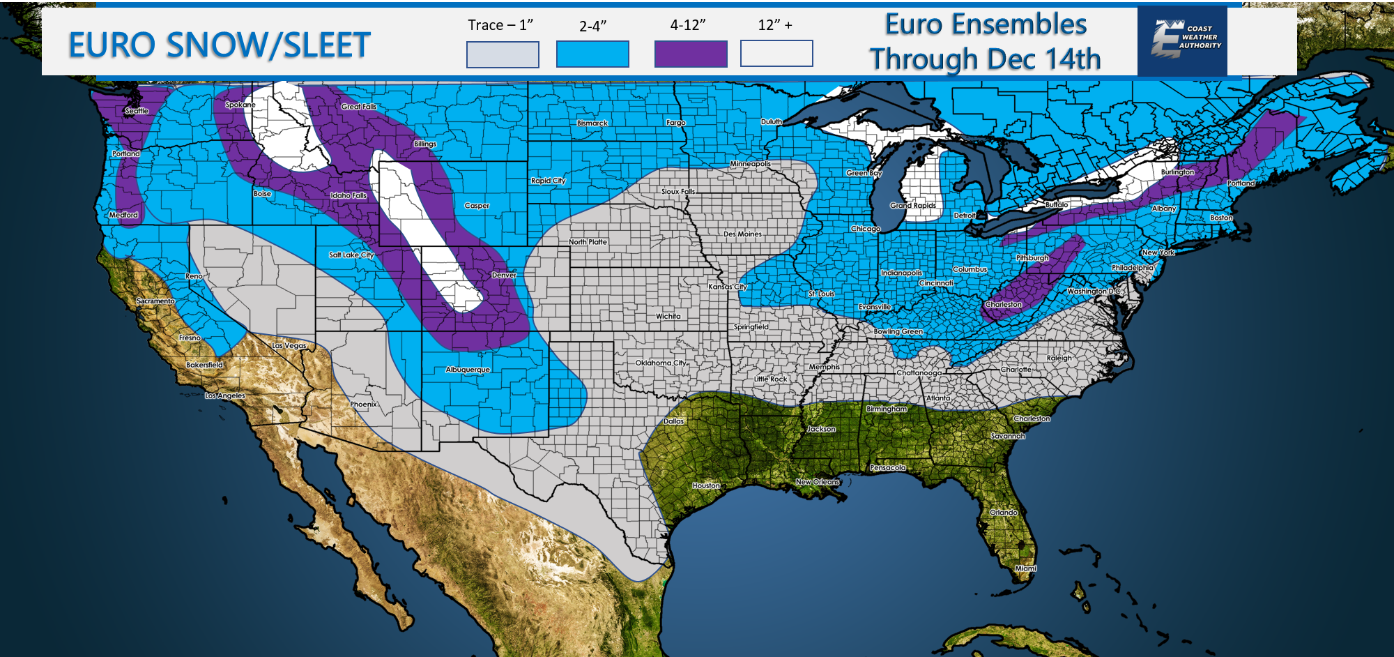
The farther south you live, the less likely you will be to see any flakes before the 14th. This especially applies to Florida, no surprise there. Also along the Gulf Coast.
If you want snow, head to one of the bright white areas!
If you would like to stay on top of the situation, become a member here > https://carolinawxauthority.com/membership-options
Also click the above link if you wish to advertise your business with us! We reach tens of thousands of people each month.
-Mike G.
Please always use you local NWS office for watches, warnings, and advisories. Please consult www.weather.gov for official information including your safety.
You must be logged in to post a comment.