
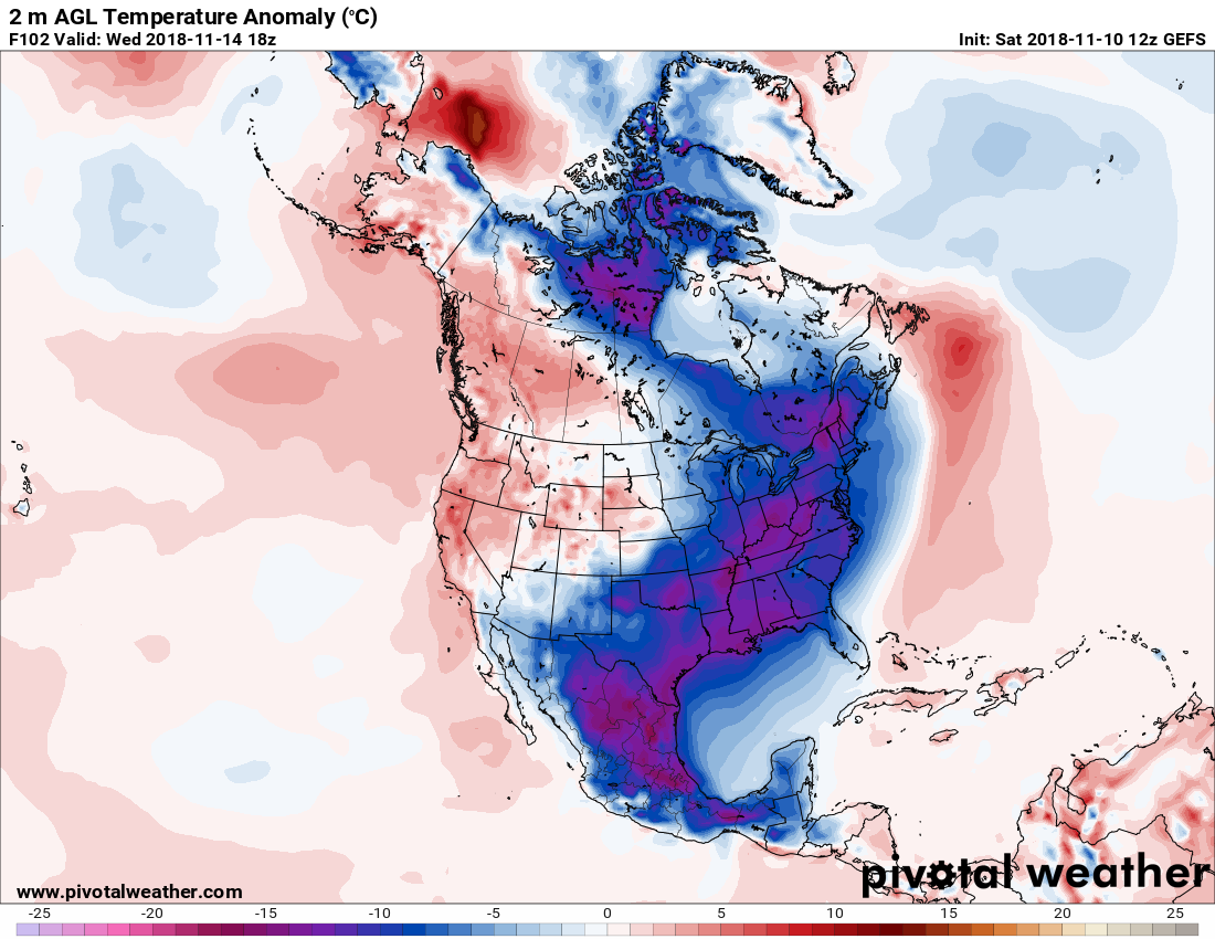
Hello members! Many of you have heard of a cold snap heading our way next week, which could be here by Wednesday early morning. Looking at the GEFS ensembles, it looks like much of the eastern side of the continent will be below normal. Yes, that is purple all the way down into Mexico! Even they will not be able to escape the cold that is about to be unleashed across the Plains as a snowstorm moves away into the Ohio River Valley. After our cold spell tonight, Saturday night into Sunday, below will be a much more significant cold outbreak next week.
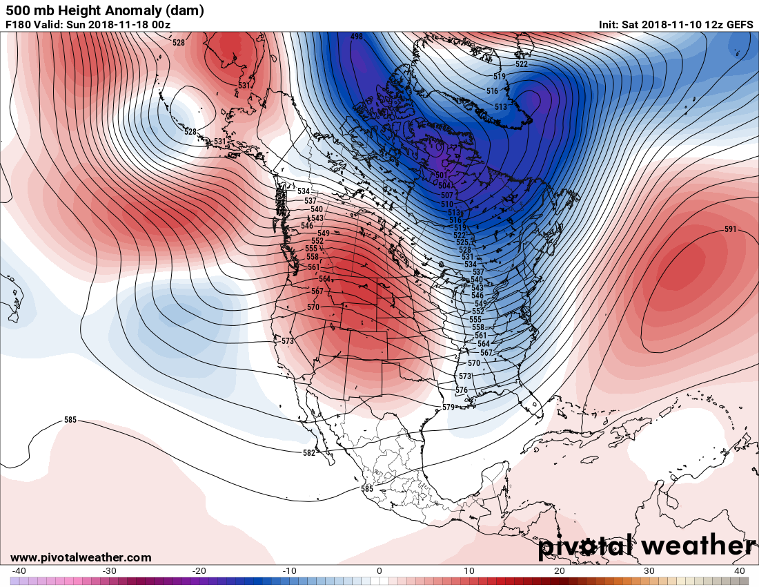
The ensembles have us in a deep trough next weekend, as lower than normal heights extend all the way from northern Canada down into Georgia. It’s safe to say late next week will also be cold. This could be a reinforcing shot of cold air late next week, or it could remain cold from the initial blast on Wednesday..
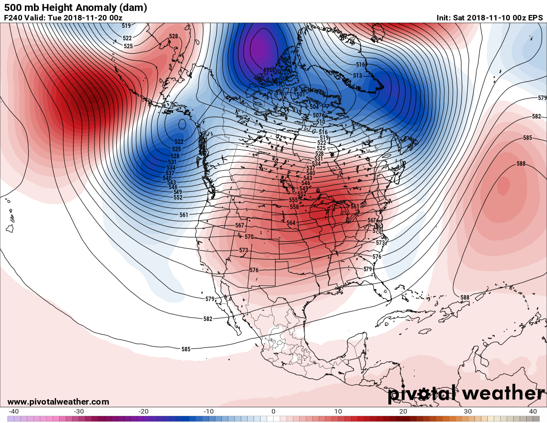
Now comes a more transient pattern as we approach Thanksgiving. Will it remain cold? The ensembles have been waffling between cold and now warm, which is expected this far out and with the limitations of long range computer guidance. But it looks like a more transient pattern into turkey day according to the GEFS.
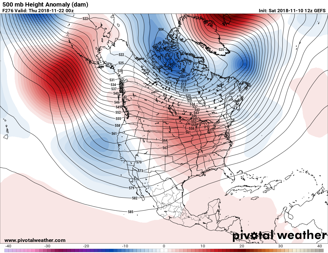
The Euro also agrees heading into the holiday we will see a ridge begin to build, so it could be a dry and warm, uneventful Thanksgiving this year.
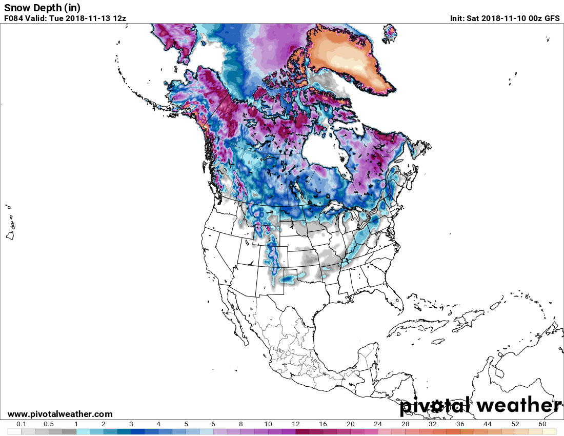
What does total snow look like? To be honest, it doesn’t look that unusual for this time of year. With all that snowpack in Canada, there will be a source for frigid arctic outbreaks to pour across the East after Thanksgiving and into early December.
You must be logged in to post a comment.