
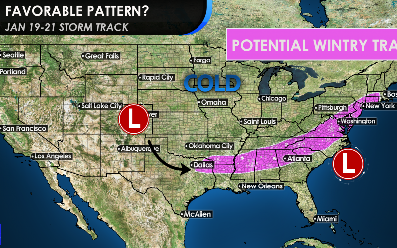
We’re not saying it’s going to snow, but the pattern certainly looks favorable around the 19th and into the 21st. We are not sure which day there will be a storm, if at all, but the way the upper air patterns are setting up, it looks like so is a favorable storm track for the South.
The purple shading above could either be snow or sleet, or a combination of both. Keep in mind, it could also be mostly rain on the east side, outside of the mountains. This is just a pretty picture to show that the storm track will become favorable in about two weeks.
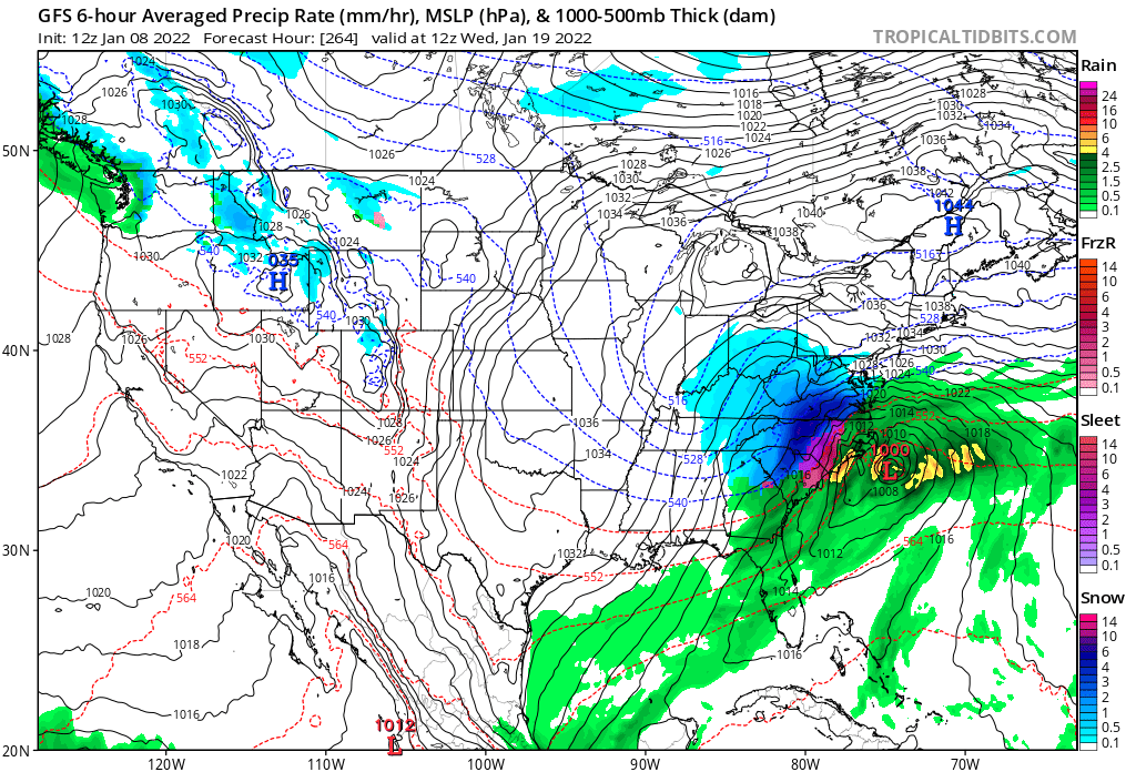
The latest GFS is looking pretty below, but we will have to see if the trend holds.
If you start to see these models become more consistent across social media, then the trend could be our friend. It is certainly the time of year for our coldest temperatures, and also winter storms, so this should not come as a big surprise.
Another signal is frigid air crashing down into the Midwest behind this storm system, and potentially heading our way.
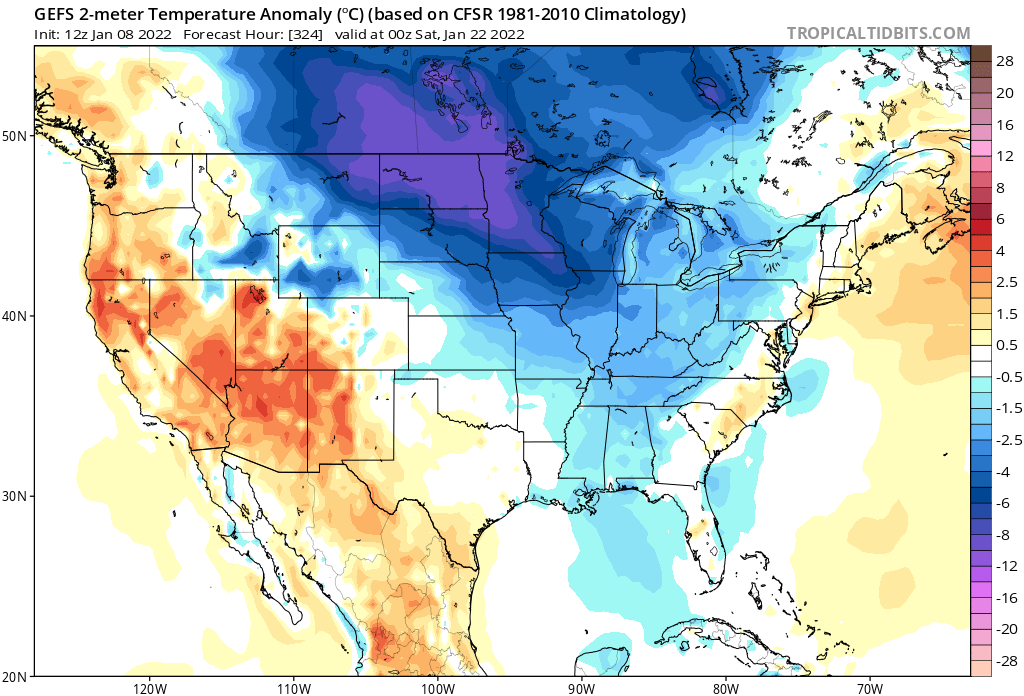
The extreme chill may or may not make it to the Carolinas, but that’s ok, as you don’t want it to be extremely cold, because then it’s “too cold” to snow.
This is certainly a huge swing from some of the temperatures we saw around Christmas.
You must be logged in to post a comment.